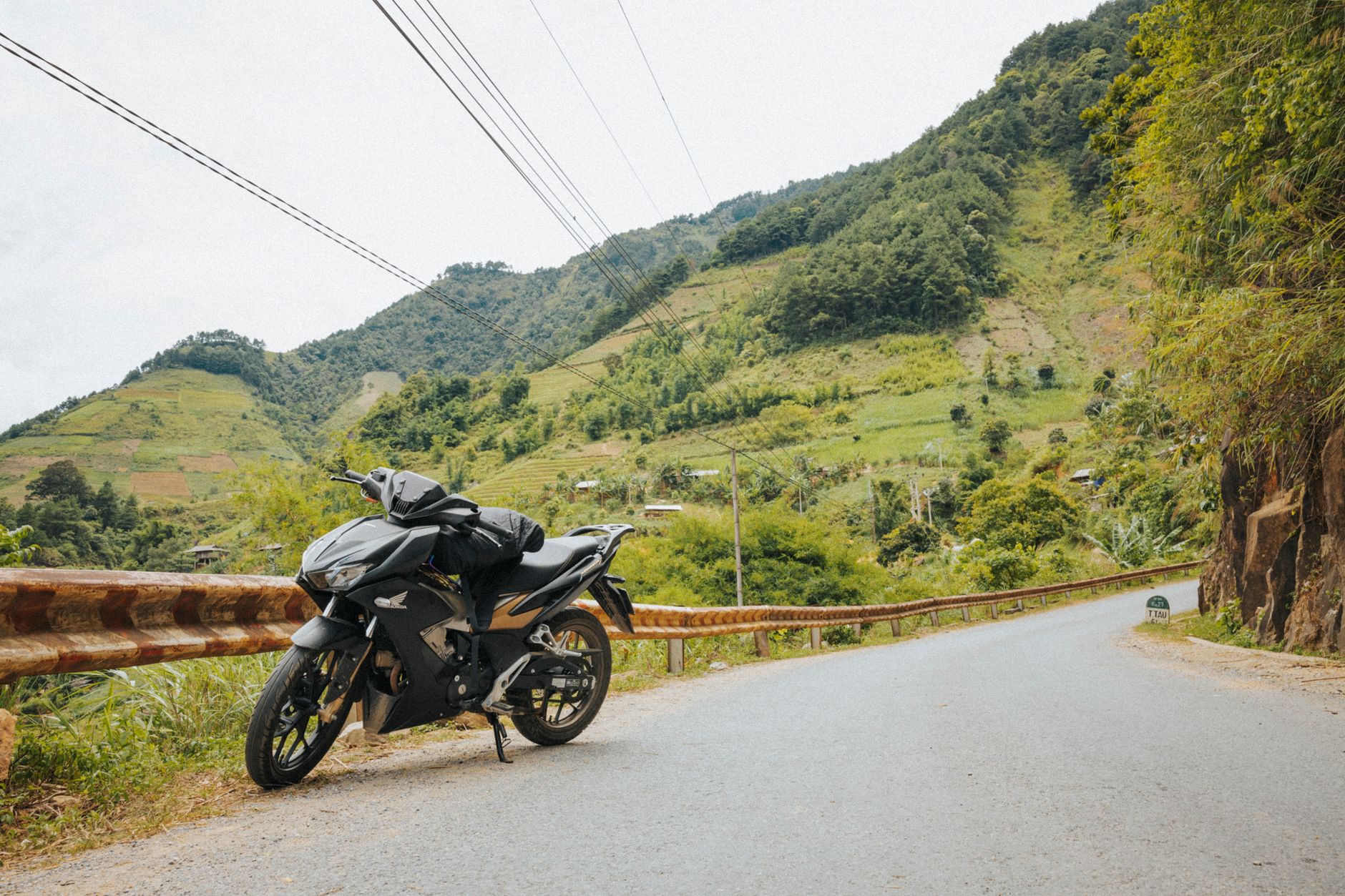
This guide covers everything needed to plan the trip in 2026: the legal paperwork, the realistic timeline, the road conditions by region, and the towns worth stopping in. No tour company pitches here. Just the facts, the routes, and the honest advice.
The legal side: what you need before you ride
Vietnam's traffic laws are clear, but enforcement varies wildly depending on where you are. The rules matter most in big cities like Hanoi and Ho Chi Minh City, where police checkpoints are routine.
The paperwork that matters:
- A valid motorcycle license from your home country
- An International Driving Permit (IDP) with an A motorcycle endorsement
- Vehicle registration papers (blue card) in your name or matching the rental agreement
- A helmet meeting Vietnamese safety standards
The IDP requirement became stricter in recent years. Vietnam officially recognizes IDPs issued under the 1968 Vienna Convention. Many travelers arrive with IDPs from countries that are not signatories, and those get rejected at checkpoints. Check before you leave home.
For the full legal breakdown, read Renting a Motorbike in Vietnam: The Legal Truth Nobody Tells Tourists.
Buying vs renting:
Most long-haul riders buy a bike in Hanoi and sell it in Ho Chi Minh City. A used Honda Win or Honda Blade costs 15 to 25 million VND ($600 to $1,000). Selling at the end recovers most of that. Rental shops in Hanoi offer one-way deals, but expect to pay a premium of 5 to 10 million VND ($200 to $400) for the drop-off service.
Pro tip: Buy from a reputable shop with a written contract, not from a backpacker hostel notice board. Stolen bikes are a real problem, and riding one means losing it at a checkpoint plus potential legal trouble.
Route overview: the classic north-to-south line
The standard route follows National Highway 1 (QL1A) for much of the way, but the best riding happens when you leave it. Here is the full breakdown by region.
| Segment | Distance | Days needed | Road quality | Highlights |
|---|---|---|---|---|
| Hanoi to Ha Giang | 300 km | 3 to 4 | Good to poor | Ha Giang Loop, Dong Van Karst Plateau |
| Ha Giang to Cao Bang | 250 km | 2 to 3 | Poor to fair | Ban Gioc Waterfall, mountain passes |
| Cao Bang to Ninh Binh | 350 km | 2 to 3 | Fair to good | Ba Be Lake, Tam Coc |
| Ninh Binh to Hue | 550 km | 3 to 4 | Good | Phong Nha caves, DMZ sites |
| Hue to Hoi An | 150 km | 1 to 2 | Excellent | Hai Van Pass, Lang Co Beach |
| Hoi An to Da Lat | 550 km | 3 to 4 | Good | Central Highlands, Kon Tum |
| Da Lat to Ho Chi Minh City | 300 km | 2 to 3 | Good to excellent | Cat Tien National Park, coastal roads |
| Ho Chi Minh City to Mekong Delta | 200 km | 2 to 3 | Good | Can Tho, floating markets |
Total distance: roughly 2,650 km. Total time: 21 to 28 days at a comfortable pace.
Northern Vietnam: Hanoi to Cao Bang (days 1 to 8)
The north is the reason most people take this trip. The mountains here are serious, the roads are challenging, and the scenery is unlike anything else in Southeast Asia.
Hanoi to Ha Giang (300 km):
Leave Hanoi early to beat the traffic. The first 150 km on QL2 are flat and boring. The fun starts after Tuyen Quang, where the road begins climbing into the mountains. The Ha Giang Loop itself needs at least 3 days. The full circuit covers the Ma Pi Leng Pass, the Dong Van Karst Plateau, and the town of Meo Vac.
The Ha Giang Loop has become famous for good reason. The roads are narrow, the drop-offs are steep, and the views are relentless. For the full route breakdown, see the Ha Giang Loop: The Honest 2026 Guide.
Ha Giang to Cao Bang (250 km):
This stretch connects two of Vietnam's best riding regions. The route crosses the Bac Sum Pass and passes through the town of Bao Lac. Road conditions vary from decent asphalt to broken concrete. Allow a full day for the 150 km from Meo Vac to Cao Bang city.
Cao Bang is the base for Ban Gioc Waterfall, one of the largest waterfalls in Asia and well worth the detour. The 90 km ride from Cao Bang city to the waterfall is scenic and mostly smooth. For more detail, read Cao Bang Loop self drive: The complete 2026 guide.
Cao Bang to Ninh Binh (350 km):
This is the least exciting stretch of the northern section. The road south through Bac Kan and Thai Nguyen is functional but forgettable. Break it up with a stop at Ba Be Lake, Vietnam's largest natural lake. The 30 km access road is rough, but the lake itself is worth the detour.
Ninh Binh marks the transition from mountains to delta. The karst landscape around Tam Coc and Trang An rivals Halong Bay without the boats. For a deeper look, read Ninh Binh in 2 Days: The Only Itinerary You Need (2026).
Warning: The north sees heavy fog and rain from December to February. Mountain passes can become genuinely dangerous. Check the forecast before committing to the Ha Giang or Cao Bang loops.
Central Vietnam: Ninh Binh to Hoi An (days 9 to 16)
Central Vietnam offers the easiest riding of the entire trip. The roads are wider, the traffic is lighter, and the coastal scenery is excellent. The region also has the most reliable weather between March and August.
Ninh Binh to Phong Nha (400 km):
The ride south follows QL1A through Thanh Hoa and Vinh. This stretch is flat, straight, and unremarkable. The reward comes at the end: Phong Nha-Ke Bang National Park.
Phong Nha deserves 2 to 3 days. The caves here are the largest in the world, and the park offers everything from easy boat tours to multi-day expeditions. For the practical details, read How to visit Phong Nha in Vietnam / A complete travel guide.
Phong Nha to Hue (250 km):
The road south from Phong Nha to Dong Hoi is excellent. From there, QL1A hugs the coast through Quang Tri province. This was the border zone during the Vietnam War, and the DMZ sites are worth a stop. The Vinh Moc Tunnels and Khe Sanh Combat Base are both accessible from the highway. For the full context, read The DMZ from Hue: Vinh Moc Tunnels, Khe Sanh & the Truth About Vietnam War Tours.
Hue to Hoi An (150 km):
This is the most famous stretch of riding in Vietnam, and it delivers. The Hai Van Pass offers sweeping views of the coast on both sides. The road is well maintained and heavily traveled by tourists, so expect company.
Hue itself deserves a full day. The Imperial City and the tombs of the Nguyen emperors are among Vietnam's most significant historical sites. For a complete guide, read Visiting Hue, Vietnam: The Complete Travel Guide to the Imperial Capital.
Hoi An is the natural rest stop. The ancient town is pedestrian-friendly, the food is excellent, and the tailors are legendary. For the full picture, read Visiting Hoi An: The Complete Travel Guide to Vietnam's Lantern City.
Pro tip: The Hai Van Pass is best ridden early morning. By 10 AM, tourist buses and vans clog the narrow sections, and the experience changes completely.
The central highlands: Hoi An to Da Lat (days 17 to 21)
Most riders skip the highlands and follow the coast south through Da Nang, Quy Nhon, and Nha Trang. That route is faster but far less interesting. The highland route through Kon Tum, Pleiku, and Buon Ma Thuot offers cooler temperatures, fewer tourists, and a completely different Vietnam.
Hoi An to Kon Tum (250 km):
The road west from Hoi An climbs steadily into the Annamite Mountains. The first 100 km are excellent riding with tight curves and jungle-covered slopes. Kon Tum is a small provincial capital with a notable wooden seminary and a strong ethnic minority presence.
Kon Tum to Buon Ma Thuot (200 km):
This stretch crosses the Central Highlands plateau. The road is good, the traffic is light, and the scenery is dominated by rubber and coffee plantations. Buon Ma Thuot is Vietnam's coffee capital. The surrounding area is home to several ethnic groups, and the local markets are genuine.
Buon Ma Thuot to Da Lat (200 km):
The road south to Da Lat is the highlight of the highlands section. It crosses several passes, including the famous Prenn Pass, and offers views over the surrounding valleys. Da Lat itself is a strange and wonderful city: French colonial villas, artificial lakes, and year-round cool weather.
For the complete highlands route, read Central highlands route: Da Lat, Buon Ma Thuot and Kon Tum by road.
Warning: The highlands get cold at night, especially from November to February. Pack a warm layer even if the coast is hot.
Southern Vietnam: Da Lat to Ho Chi Minh City and the Mekong Delta (days 22 to 28)
The south is flat, hot, and busy. The riding is easy, but the traffic requires constant attention. The final stretch into Ho Chi Minh City is the most stressful part of the entire trip.
Da Lat to Ho Chi Minh City (300 km):
The road south from Da Lat descends through the Cat Tien National Park area before flattening out into the agricultural plains. The final 50 km into Ho Chi Minh City is urban riding at its most chaotic. Allow extra time and keep your wits about you.
Ho Chi Minh City to the Mekong Delta (200 km):
The Mekong Delta is the natural end point for the trip. The roads are good, the landscape is lush, and the pace of life slows dramatically. Can Tho is the best base for exploring the floating markets at Cai Rang and Phong Dien. For the full guide, read Mekong Delta itinerary: how to plan 2 to 4 days beyond the day trip.
Sell the bike in Ho Chi Minh City and fly home from Tan Son Nhat International Airport. Most buyers are expats or tour companies, and the process takes a day or two.
Road conditions and weather by region
Vietnam's roads vary from brand-new expressways to broken mountain tracks. Here is the honest breakdown by region.
Northern mountains (Ha Giang, Cao Bang):
Expect narrow roads, steep gradients, and frequent potholes. Some sections are unpaved. Rain turns the surface to slick clay. This is the most demanding riding in Vietnam, and it requires experience.
Red River Delta (Ninh Binh, Hanoi):
Flat, straight, and heavily trafficked. The roads are paved but often crowded with trucks and buses. This is the least interesting riding of the trip.
North Central coast (Thanh Hoa to Hue):
Wide roads with moderate traffic. Some construction zones. The weather is the biggest variable, with heavy rain from September to November.
Central coast (Hue to Hoi An):
Excellent roads with light traffic. The Hai Van Pass is the highlight. This is the easiest and most scenic riding in the country.
Central Highlands (Kon Tum to Da Lat):
Good roads with very light traffic. The terrain is rolling, and the curves are well engineered. Cooler temperatures make this the most comfortable riding in Vietnam.
Southeast and Mekong Delta:
Flat, straight, and heavily trafficked. The roads are paved but often crowded with trucks, buses, and agricultural vehicles. Expect frequent stops at roundabouts and traffic lights.
For the seasonal breakdown, read Vietnam Weather by Month: The Best Time to Visit Each Region.
Budget breakdown for 2026
A motorbike trip in Vietnam is one of the cheapest ways to see the country, but costs add up faster than expected.
| Item | Daily cost (VND) | Daily cost (USD) |
|---|---|---|
| Fuel | 60,000 to 100,000 | $2.50 to $4 |
| Food | 150,000 to 300,000 | $6 to $12 |
| Accommodation | 150,000 to 400,000 | $6 to $16 |
| Repairs and maintenance | 20,000 to 50,000 | $1 to $2 |
| Attractions and entry fees | 50,000 to 200,000 | $2 to $8 |
Total daily budget: 350,000 to 700,000 VND ($14 to $28). A month on the road costs between 10 and 20 million VND ($400 to $800), not including the bike.
Buying a bike adds 15 to 25 million VND ($600 to $1,000) upfront, but selling it at the end recovers most of that.
Essential gear and preparation
The right gear makes the difference between a great trip and a miserable one. Here is the minimum list:
- Full-face helmet with a clear visor
- Riding gloves with knuckle protection
- A waterproof jacket and pants
- A basic tool kit with tire repair kit
- A phone mount with a USB charger
- A power bank for long days
Rain gear is non-negotiable. Vietnam's monsoon rains arrive quickly and pour hard. For the seasonal details, read Visiting Vietnam in the rainy season: how to plan around the monsoon.
Pro tip: Buy a SIM card with a data plan at the airport. Grab and Google Maps work well across Vietnam, and having reliable navigation reduces the stress of riding in unfamiliar cities. See the Vinaphone tourist SIM price official: Complete 2026 guide for Vietnam travelers for current options.
FAQ
Q: Do I need an International Driving Permit to ride a motorbike in Vietnam? Yes. Vietnam requires an IDP with a motorcycle endorsement. Permits issued under the 1968 Vienna Convention are accepted. Check your home country's agreement before leaving.
Q: Is it better to buy or rent a motorbike for the north-to-south trip? Buying works best for trips longer than 2 weeks. A used bike costs 15 to 25 million VND ($600 to $1,000) and sells for most of that at the end. Renting with a one-way drop-off costs more but requires less hassle.
Q: How many days should I plan for the full route? Most riders need 3 to 4 weeks. The minimum realistic time is 18 days, but that leaves little room for rest days or detours. A month allows for a comfortable pace.
Q: What is the best time of year to ride north to south? March to May and September to November offer the best balance of weather across all regions. July and August bring heavy rain and typhoons to central Vietnam. December to February is cold and foggy in the north.
Q: Is the Ha Giang Loop safe for inexperienced riders? No. The Ha Giang Loop requires experience with mountain roads, steep gradients, and poor surfaces. Inexperienced riders should consider taking a guided tour or skipping the loop entirely.
Q: Can I ride the whole route on a small scooter like a Honda Blade? Yes, but it will be slow. The 110cc engine struggles on mountain passes and long climbs. A 150cc bike like the Honda Winner or Yamaha Exciter handles the terrain much better.
Q: What should I do with my bike at the end of the trip? Sell it in Ho Chi Minh City. Several shops buy used bikes from travelers. Expect to lose 20 to 30 percent of the purchase price if the bike is in good condition.