Map of Vietnam
The whole country on one page: the North, the Centre and the South in three colours, the 17 destinations most travellers visit, the Reunification Express line from Hanoi to Ho Chi Minh City, and the six international airports. Print it on A4 before you leave, or keep the PNG on your phone.


Free for personal use · PDF · PNG · SVG
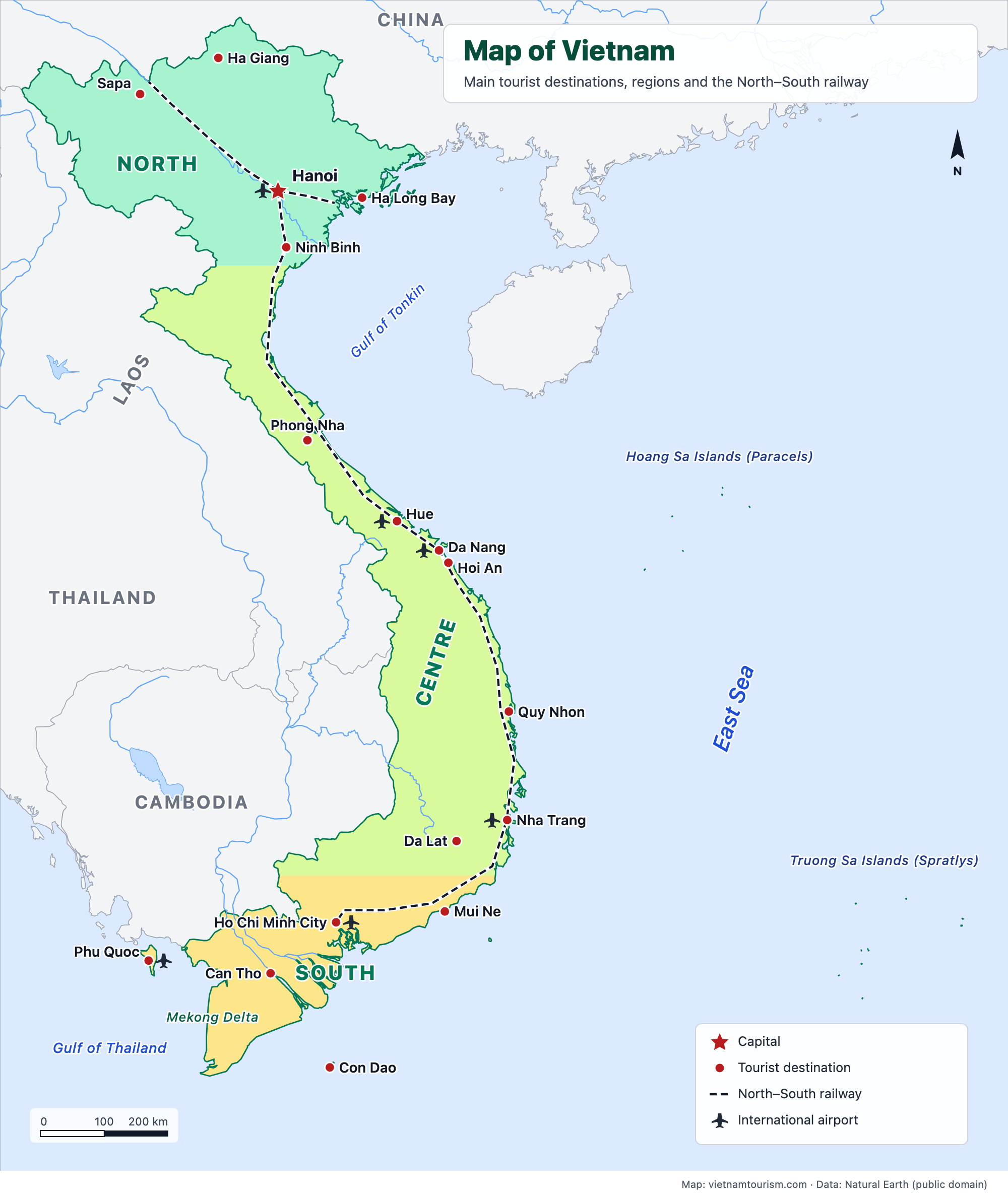
What's on the map
- Hanoi
- Sapa
- Ha Giang
- Ha Long Bay
- Ninh Binh
- Phong Nha
- Hue
- Da Nang
- Hoi An
- Quy Nhon
- Nha Trang
- Da Lat
- Mui Ne
- Ho Chi Minh City
- Can Tho
- Phu Quoc
- Con Dao
- Hoang Sa Islands (Paracels)
- Truong Sa Islands (Spratlys)
Other maps
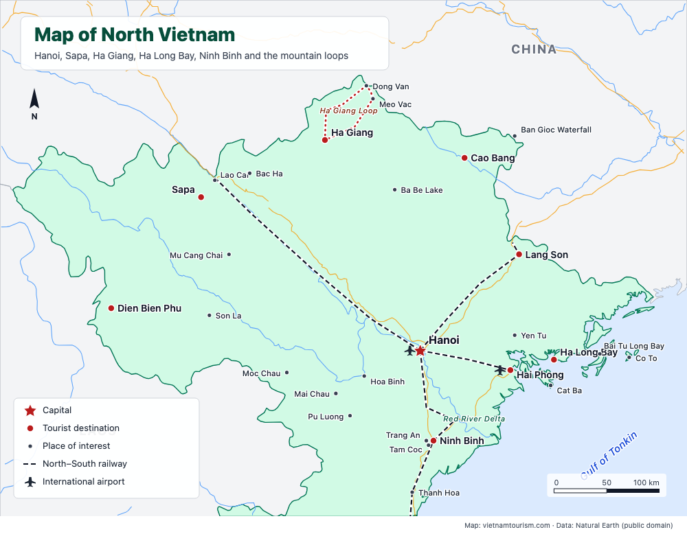
Map of North Vietnam
Free printable map of North Vietnam: Hanoi, Sapa, Ha Giang, Ha Long Bay, Ninh Binh, Cao Bang, Ba Be, Mai Chau, the railway lines and main roads, 28 places. PDF, PNG and SVG.
PDF · PNG · SVG
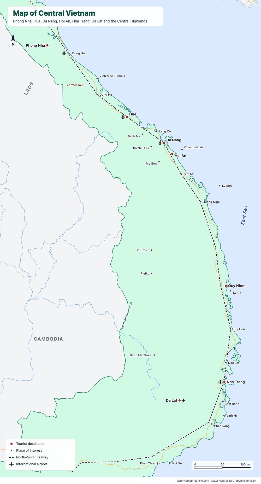
Map of Central Vietnam
Free printable map of Central Vietnam: Phong Nha, Hue, Da Nang, Hoi An, My Son, Quy Nhon, Nha Trang, Da Lat and the Central Highlands, railway and roads, 30 places. PDF, PNG and SVG.
PDF · PNG · SVG
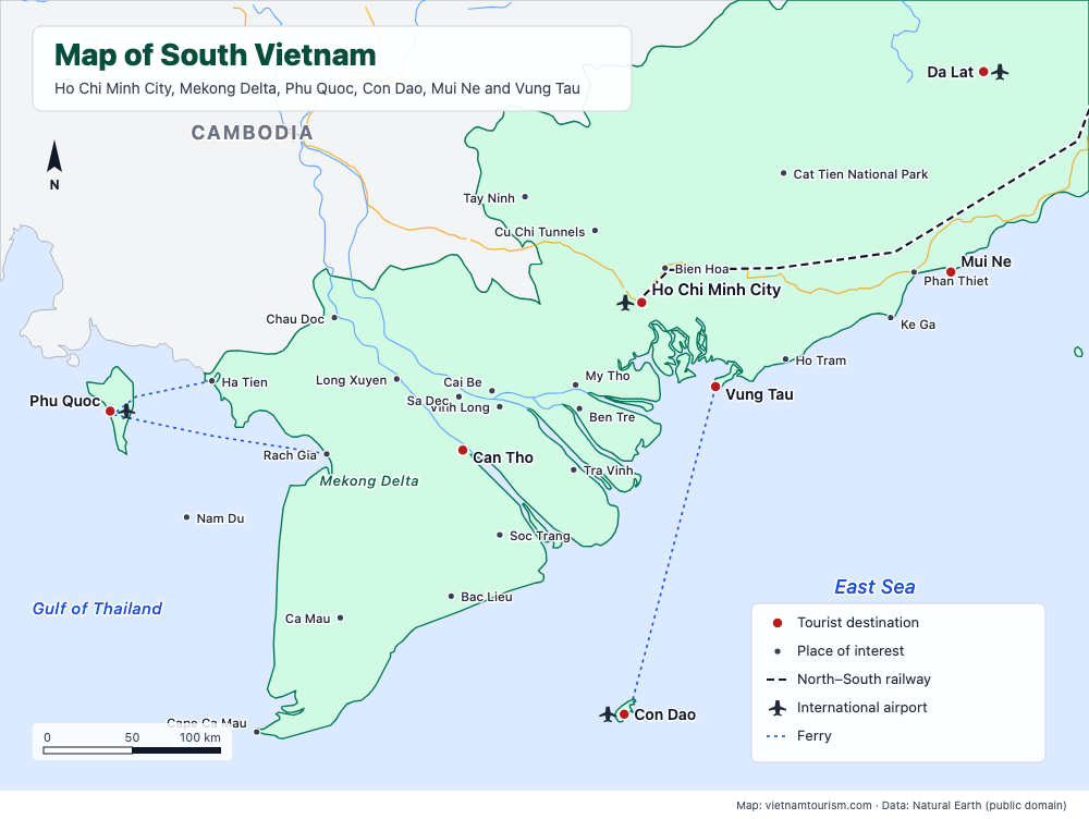
Map of South Vietnam
Free printable map of South Vietnam: Ho Chi Minh City, Cu Chi, Vung Tau, Mui Ne, Da Lat, the Mekong Delta towns, Chau Doc, Ha Tien, Phu Quoc and Con Dao, roads and ferries, 29 places. PDF, PNG and SVG.
PDF · PNG · SVG
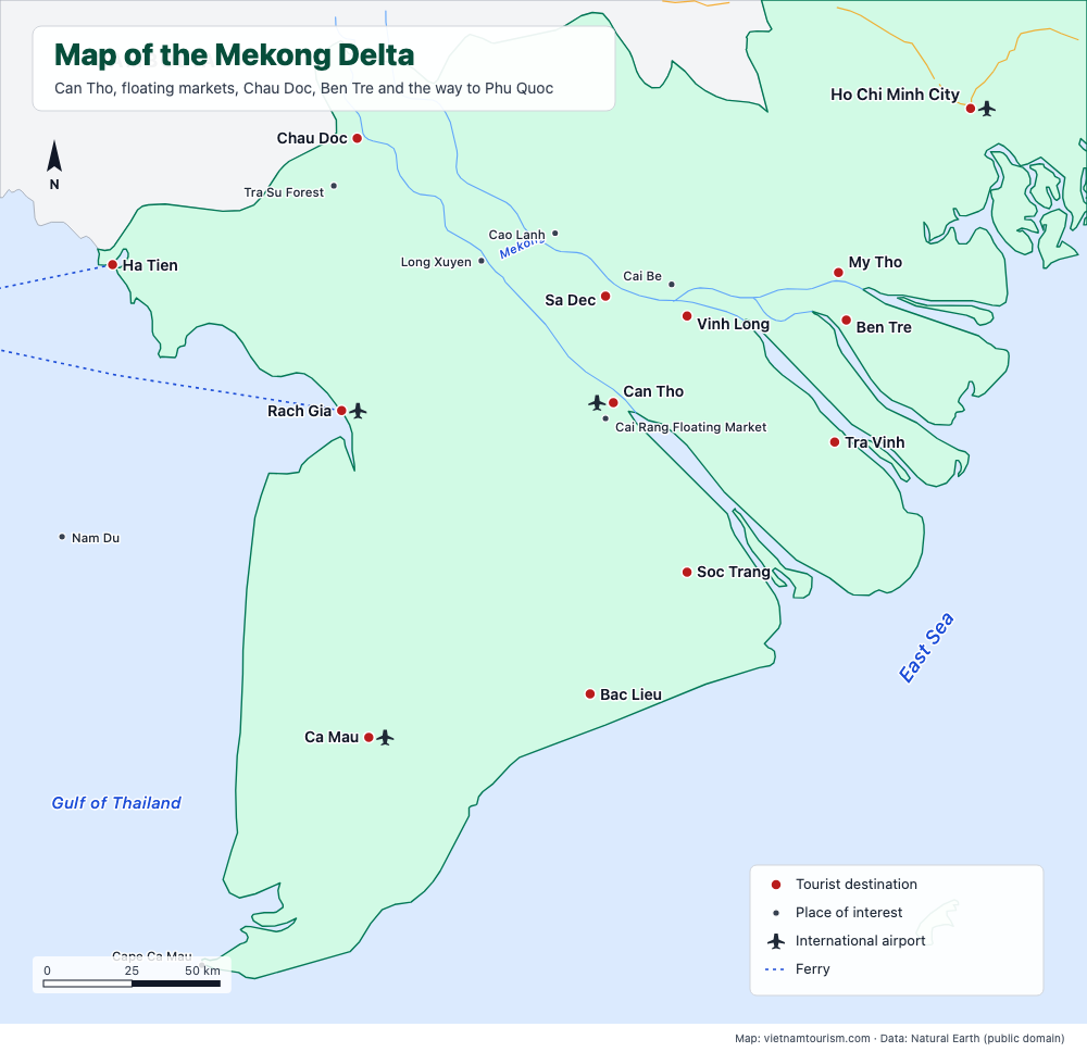
Map of the Mekong Delta
Free printable map of the Mekong Delta: My Tho, Ben Tre, Vinh Long, Cai Be, Can Tho and Cai Rang floating market, Chau Doc, Tra Su, Ha Tien, Rach Gia, Ca Mau and the ferries to Phu Quoc, 21 places. PDF, PNG and SVG.
PDF · PNG · SVG
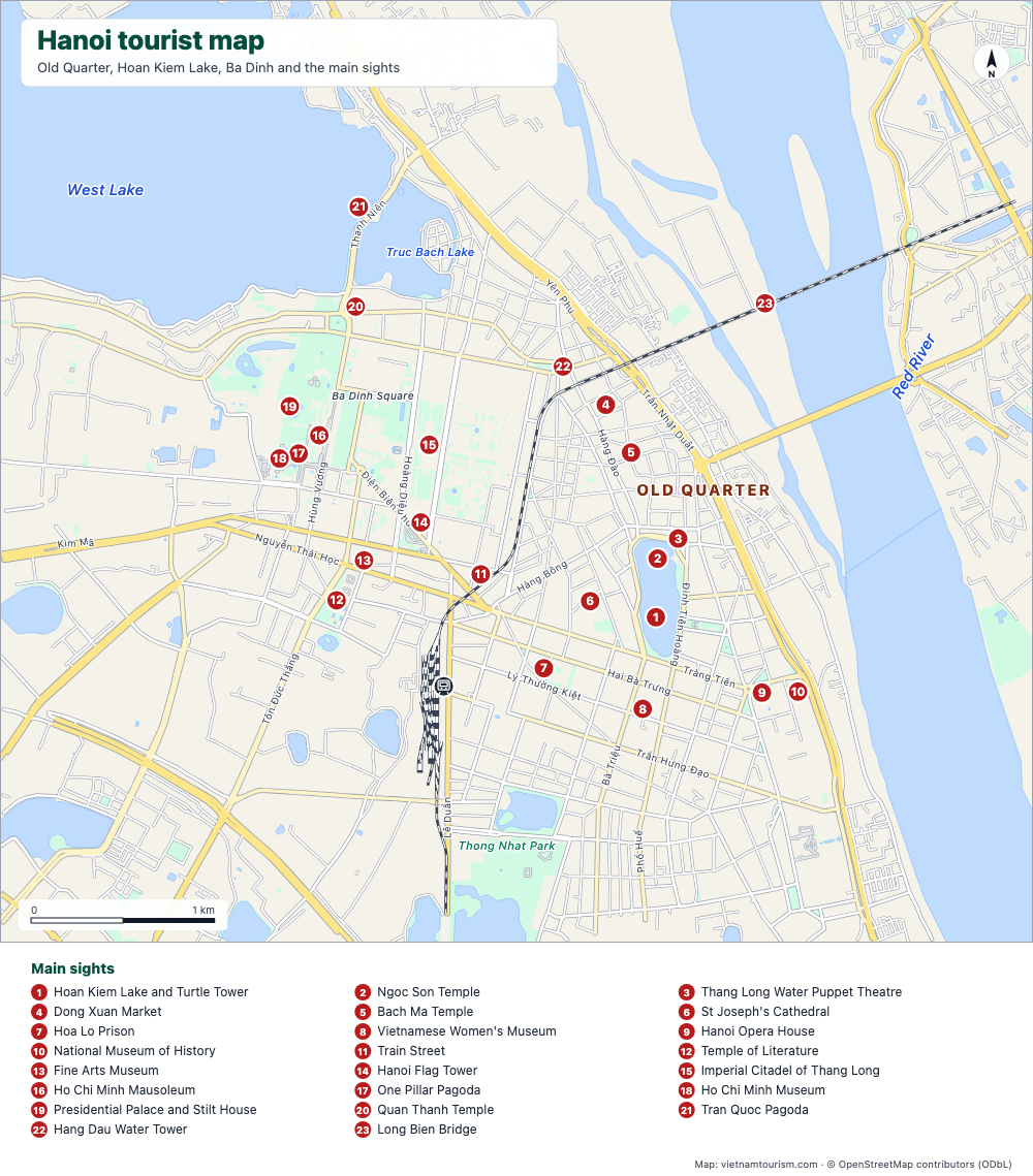
Hanoi tourist map
Free tourist map of Hanoi to print: Old Quarter, Hoan Kiem Lake, Ba Dinh, 23 numbered sights, main streets and the train station. PDF, PNG and SVG.
PDF · PNG · SVG
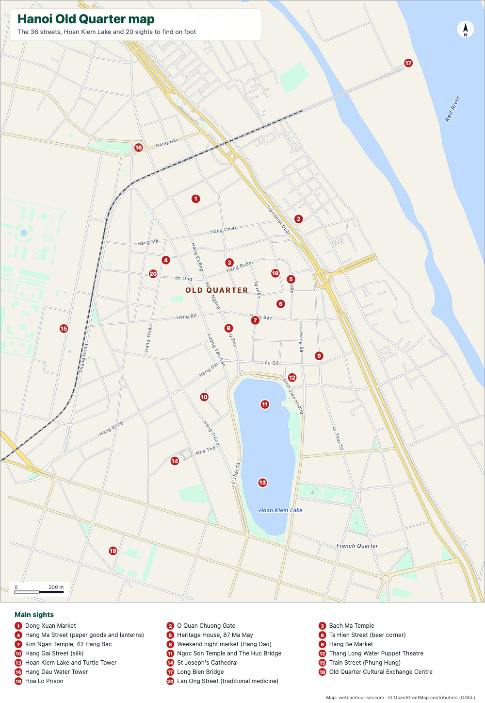
Hanoi Old Quarter map
Free printable map of Hanoi's Old Quarter: the 36 guild streets with their names, Dong Xuan Market, Bach Ma Temple, Hoan Kiem Lake and 20 numbered sights. PDF, PNG and SVG.
PDF · PNG · SVG