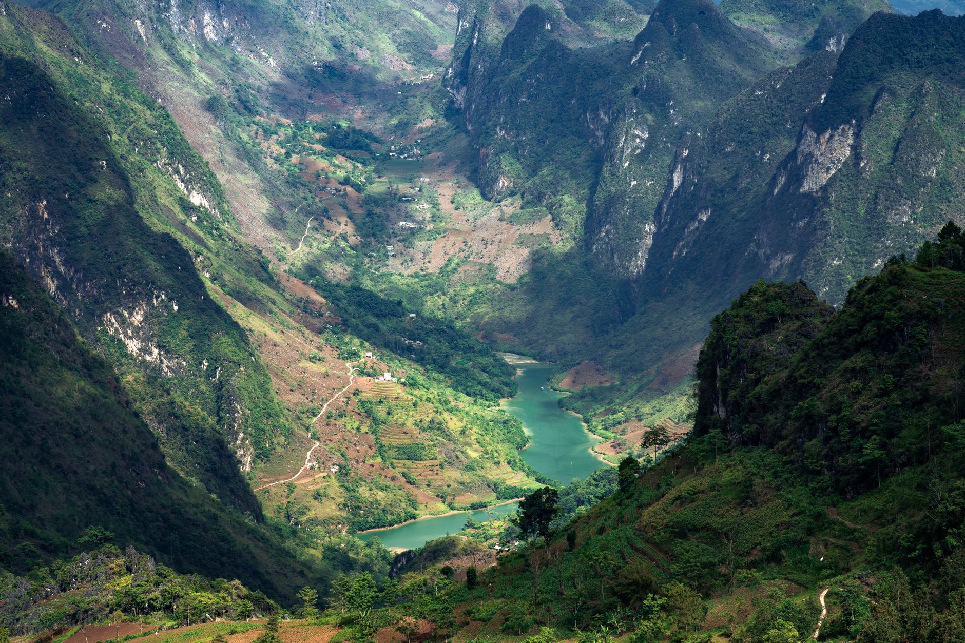
Ma Pi Leng at a glance
| Item | Detail | Note |
|---|---|---|
| Location | National Highway 4C (QL4C), between Dong Van and Meo Vac | Since the July 2025 provincial merger, the former Ha Giang province is part of Tuyen Quang province; Dong Van and Meo Vac are now communes rather than districts |
| Length | About 20 km for the pass | The most dramatic section is shorter, roughly 8-10 km around the summit |
| Altitude | About 1,200 m | Approximate, commonly cited figure |
| Entrance fee | None widely reported for the road or path | As of October 2026; confirm on the ground |
| Opening hours | Road open 24 hours; sky path realistically daylight only | As of October 2026 |
| Time needed | Under 1 hour driving; 2-3 hours with the short sky path; half a day to a full day with the full traverse and Nho Que boat | |
| Best months | October to December, then March to April |
The administrative change matters for maps, permits and news searches. Few guides mention it. If you are looking up bus schedules or local regulations, search under Tuyen Quang as well as Ha Giang.
The story behind the pass
What "Ma Pi Leng" means
The name is usually translated from H'mong as "the bridge of a horse's nose". The image is a ridge so steep that horses lost their breath climbing it. Etymologies vary between sources and this is the traditional explanation rather than a settled fact.
The Happiness Road, 1959-1965
The Happiness Road (Đường Hạnh Phúc) runs about 185 km from Ha Giang town to Dong Van and Meo Vac. It was built by youth volunteers and labourers from 16 ethnic groups, commonly said to come from several northern provinces. Workers used hand tools and explosives. On the Ma Pi Leng section they hung from ropes on the cliff face for about 11 months.
Before the road, Dong Van and Meo Vac were days away on foot from the provincial capital. The road served integration, administration and defence of a border district that sits only a few kilometres from China. Casualty figures are disputed between sources. Many workers died, and that is as precise as the record allows.
Recognition: national scenic site and UNESCO geopark
Ma Pi Leng was classified as a national scenic site in 2009. The Dong Van Karst Plateau joined the UNESCO Global Geoparks Network in 2010. Geopark status is a geological and cultural label, not a protected park with gates and tickets. You will not find an entrance booth or a ranger station on the pass.
The Panorama controversy
In 2017 a multi-storey tourist building was erected at the summit. Public outrage over the scar on the landscape led the province to order it cut down in height. Today the "Ma Pi Leng Panorama" café and viewing building is the result. Knowing this story helps explain what you see at the top: a squat, functional structure where an oversized one was planned.
Reading the landscape: Nho Que River, Tu San Canyon and the White Cliff
The Nho Que River rises in Yunnan, China, and flows through the gorge into Vietnam. Tu San Canyon is often described as the deepest canyon in Southeast Asia, with depth figures quoted around 700-900 m. Treat this as a claim rather than an established fact. The White Cliff (Vách Đá Trắng) is the pale limestone wall that the long sky path follows.
The river's emerald colour is strongest in the dry season. It runs brown with silt in the rainy months. Part of the stretch below the pass is now a reservoir created by hydropower dams, which explains the lake-like look and the shifting water levels.
Driving the pass, spot by spot
This sequence runs from Dong Van to Meo Vac, the direction most loops take on day three.
1. Leaving Dong Van. Maize grows in rock pockets, H'mong houses with mud walls line the road, and the first bends climb out of the valley.
2. The first canyon reveal. At the first big bend the gorge opens suddenly. This is a good roadside pull-out, but parking space is limited.
3. The summit area. The monument to the Happiness Road volunteers carries an inscription most visitors never read. The carved "Mã Pì Lèng" name stone is the classic photo spot. The Panorama café and viewing building sits nearby, along with toilets, drink stalls and children selling flowers.
4. The sky path trailhead. Located near the monument. Look for the signage (reviewers mention a red sign), the concrete access track and the fork where the short and long routes diverge.
5. Downstream pull-outs. Successive viewpoints over the White Cliff and Tu San, with the side road down toward Xin Cai and the boat landing.
6. Descent to Meo Vac. Hairpins, then the valley town and its Sunday market.
If you only have time for one stop, skip the crowded summit and drive ten minutes further toward Meo Vac. The downstream pull-outs give you the same canyon without the tour vans.
The Ma Pi Leng sky path, step by step
What the "skywalk" actually is (and is not)
It is a narrow concrete footpath with stairs in sections, cut along the cliff above the road. It is not a glass skywalk. Set expectations accordingly if you searched "skywalk" expecting one. It is sometimes confused with the viewing ledge at the Panorama building, which is a different thing entirely.
Option 1: the short out-and-back
Start near the monument and walk to the first unobstructed ledges and the "pointing finger" rock formation. Return the same way. Allow about 1-1.5 hours.
Option 2: the one-way traverse along the White Cliff
The route passes a small White H'mong hamlet and views over Pai Lung village. It continues along the cliff, with railings on some sections and none on others, then descends via many steps toward the Tu San viewpoint and the lower panorama viewpoint. Distance is about 5-6 km and the walk takes up to 3 hours. It requires a pickup at the far end. If you need to bail out early, the hamlet is the natural turnaround point.
| Route | Start | End | Distance | Time | Difficulty | Barriers | Pickup needed |
|---|---|---|---|---|---|---|---|
| Short out-and-back | Monument | Pointing finger rock | About 2-3 km return | 1-1.5 hours | Easy, some exposure | None on ledges | No |
| One-way traverse | Monument | Tu San viewpoint | About 5-6 km | Up to 3 hours | Moderate, many stairs | Partial railings | Yes |
Difficulty, vertigo and the motorbike ban
The terrain is mostly easy underfoot, but there are sheer unfenced drops. Motorbikes are not permitted for tourists on the path, and the stairs make riding it impossible anyway. People with vertigo should stick to Option 1 or skip the path entirely. Wear shoes with grip. The concrete is slippery when wet or misty.
How Ma Pi Leng compares with other passes
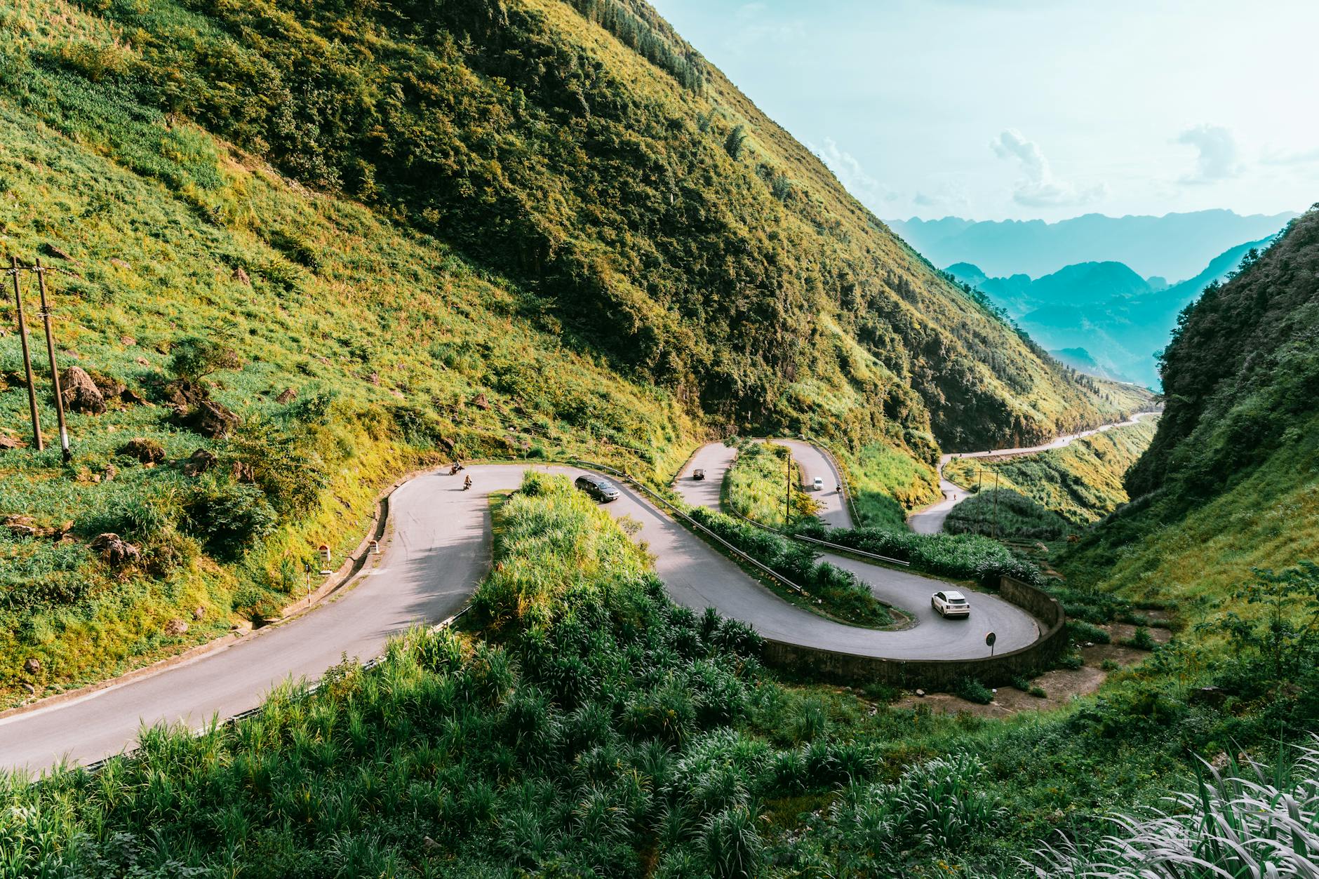
On the same loop, Tham Ma Pass gives you the zigzag road viewed from above, and Quan Ba Heaven Gate gives you the valley panorama. Ma Pi Leng is the only one with a deep canyon and a river.
| Pass | Province | Altitude | Type of view | Crowds | Verdict |
|---|---|---|---|---|---|
| Ma Pi Leng | Tuyen Quang (formerly Ha Giang) | About 1,200 m | Deep canyon, river, limestone cliff | Heavy 9:00-11:00 | Wins on vertical drama |
| O Quy Ho | Lao Cai | About 2,000 m | Long high ridge, Fansipan views | Moderate | Longer and higher |
| Pha Din | Dien Bien / Son La | About 1,600 m | Broad mountain saddle | Light | Quieter, less dramatic |
| Khau Pha | Yen Bai | About 1,200 m | Rice terraces, paragliding | Moderate | Better for rice country |
Ma Pi Leng wins on vertical drama. O Quy Ho is longer and higher. Khau Pha is better if you want rice terraces.
Is it worth it? Who will love it and who may be disappointed
Who will love it:
- Hikers.
- Photographers on clear days.
- Anyone interested in the Happiness Road story.
- Travellers who want the single most dramatic view in northern Vietnam.
Who may be disappointed:
- Visitors on foggy winter mornings, when the canyon can be completely invisible.
- People expecting golden rice terraces. Ma Pi Leng is karst with maize, not rice country.
- Travellers who hate crowds in October.
- Anyone hoping for a glass skywalk.
Verdict: worth the detour even on a short Ha Giang trip if the weather forecast is clear. Build in a weather buffer day if possible.
When to go: season and hour
Season by season
| Month | Weather | Visibility | River colour | Crowds | Highlights |
|---|---|---|---|---|---|
| Jan-Mar | Cold, foggy | Often poor | Emerald to grey | Light | Peach and plum blossom |
| Mar-Apr | Mild | Clear spells | Emerald | Moderate | Good walking weather |
| May-Sep | Rainy, landslide risk | Often blocked | Brown with silt | Light | Green landscape |
| Oct-Dec | Dry, clear, cold | Best | Emerald | Peak | Buckwheat flowers |
Temperatures in Dong Van can approach freezing in winter.
Dated events
Buckwheat flower season usually runs late October to December, so it is running at the time of writing in October 2026. Tet 2027 falls on 6 February 2027. Local life slows down and transport fills up. Khau Vai Love Market is held on the 27th day of the 3rd lunar month, expected around 3 May 2027. Confirm locally announced dates.
Best hour and beating the crowds
Most loop groups leave Dong Van homestays and hit the summit between about 9:00 and 11:00. That is the busiest window. Go before 8:30, or after about 15:00 for softer light and fewer people. Winter fog often lifts by mid to late morning. Check conditions from the Dong Van side before setting off.
Tickets, opening hours, permits and rules
Entrance fee: as of October 2026, no entrance fee is widely reported for driving the pass or walking the sky path. They are an open-air road and a public path. Confirm this on the ground. If a fee has been introduced, expect it in VND with USD/EUR equivalents (approx. 26,000 VND = US$1, about 30,000 VND = €1; check current rates).
Panorama building: may require buying a drink to access its terraces. Expect a coffee or juice in the 40,000-70,000 VND range (US$1.50-2.70) as a last known figure, flagged as variable.
Opening hours: the road is open 24 hours. The sky path is walkable in daylight only, realistically.
Closures: heavy rain, landslides, and occasional roadworks on QL4C.
Border area permit: historically, foreigners needed one for the Dong Van and Meo Vac area, usually arranged by accommodation in Ha Giang town. Requirements have changed several times, including after the 2025 merger. Confirm with your accommodation in Ha Giang town before departure.
Drones: a flight licence is legally required in Vietnam, and the pass is close to the Chinese border. Confiscation is a real risk.
Dress and photography: no formal dress code. Ask before photographing people. Some children and costumed locals expect a small payment for photos.
How to get there
From Hanoi to Ha Giang town. Sleeper bus or limousine van, about 6-7 hours, last known fares around 250,000-500,000 VND (US$10-19). Expressway projects are shortening the trip; check their status as of October 2026.
From Ha Giang town to Dong Van or Meo Vac. About 145-165 km of mountain road. Options include local bus (slow, cheap), self-ride, easy rider, and private car.
From Dong Van or Meo Vac to the pass. There is no Grab in this area. The summit lies roughly 10-12 km from Dong Van and 9-10 km from Meo Vac, about 25-30 minutes by road. Options include a rented motorbike from Dong Van, a xe ôm with waiting time agreed in advance, or a private car arranged through accommodation.
Do it without the full loop. Make Dong Van a base for two nights and do Ma Pi Leng as a half-day trip.
Safety, etiquette and what most visitors miss
Real risks on the road
Blind hairpins, trucks and tour vans on narrow bends, gravel, fog and wet surfaces. Foreign rider accidents happen on the Ha Giang Loop, and inexperienced self-riders are the main risk group. Riding legally requires a valid Vietnamese licence or an IDP under the 1968 convention. Many travel insurance policies refuse claims without one. Medical care is limited locally; serious cases go to Ha Giang town or Hanoi.
Real risks on foot
Do not step onto overhanging rock ledges for photos. Keep children close where there are no barriers. Turn back in fog or rain.
Etiquette
Do not hand out sweets or money to children. Buy from local stalls instead. Do not walk through maize plots or enter houses on the path uninvited. Carry rubbish out, as there are few bins along the path.
What most visitors miss
The monument's inscription and the volunteers' story get photographed and forgotten. The lower viewpoints downstream over Tu San are often better than the crowded summit. Light direction on the White Cliff changes through the day, so morning and afternoon give different photographs. The river's colour shifts between emerald in the dry season and brown with silt in the rainy months.
What to combine nearby
| Place | Distance from summit | Time needed | Last known fee |
|---|---|---|---|
| Nho Que River boat trip through Tu San Canyon | Via side road from QL4C | 1.5-2 hours | About 150,000-200,000 VND (US$6-8) per person |
| Dong Van old quarter and Sunday market | About 10-12 km | 2-3 hours | Free |
| Meo Vac Sunday market | About 9-10 km | 1-2 hours | Free |
| Pa Vi Ha village | A few km from Meo Vac | 1 hour | Free |
| Vuong family mansion, Sa Phin | About 25 km from Dong Van | 1 hour | Small ticket fee, confirm locally |
| Lung Cu Flag Tower and Lo Lo Chai village | About 25 km from Dong Van | 2 hours | Small ticket fee, confirm locally |
The Nho Que boat trip is reached via the side road from QL4C toward the boat landing. Note the walk down from the landing and the time needed.
FAQ
Q: Is there an entrance fee for Ma Pi Leng Pass or the skywalk? As of October 2026, no ticket is widely reported for driving the pass or walking the sky path. The Panorama café may expect a drink purchase. Check locally because new fees can appear without notice.
Q: Is the Ma Pi Leng skywalk a glass platform? No. It is a concrete footpath with stairs along the cliff, partly without railings. The word "skywalk" is used loosely online.
Q: How long does the Ma Pi Leng sky path take? About 1-1.5 hours for the short out-and-back from the monument. About 3 hours (5-6 km) for the one-way traverse along the White Cliff, which needs a pickup at the end.
Q: Can you ride a motorbike on the sky path? No. Motorbikes are not permitted for tourists, and stairs make it physically impossible anyway. Riders park near the trailhead and walk.
Q: Is Ma Pi Leng Pass dangerous? The road risks are real: hairpins, trucks, fog, gravel. The path has unfenced drops. Self-riders without a valid licence risk insurance refusal after an accident. An experienced rider or a local driver reduces the risk considerably.
Q: Do foreigners need a permit to visit Ma Pi Leng? Historically yes, usually arranged by accommodation in Ha Giang town. Rules have changed several times, including after the 2025 merger into Tuyen Quang province. Confirm with accommodation in Ha Giang town before departure.
Q: What is the best time of day to visit Ma Pi Leng? Before 8:30 or after 15:00 to avoid tour groups. In winter, fog often clears by mid to late morning, so flexibility beats a fixed schedule.
Q: Can you visit Ma Pi Leng without doing the whole Ha Giang Loop? Yes. Base yourself in Dong Van for two nights and do Ma Pi Leng as a half-day trip by xe ôm or private car. The 6-7 hour trip from Hanoi to Ha Giang, plus the onward journey to Dong Van, still makes it a multi-day trip.
Your questions and tips
A question, an update, an experience to share? Our team reads every message before it is published.
No comments yet. Ask the first question or share a tip!