Hanoi metro map
The two lines in service: Line 2A, elevated, from Cat Linh near the Temple of Literature to Yen Nghia in Ha Dong (13 km, 12 stations, open since 2021), and the elevated section of Line 3 from Nhon to Cau Giay (8.5 km, 8 stations, open since August 2024); the underground section towards Hanoi station is still under construction. Neither line reaches the Old Quarter or Hoan Kiem Lake yet, which is why the map also shows them for orientation. Tickets cost 8,000 to 15,000 dong.


Free for personal use · PDF · PNG · SVG
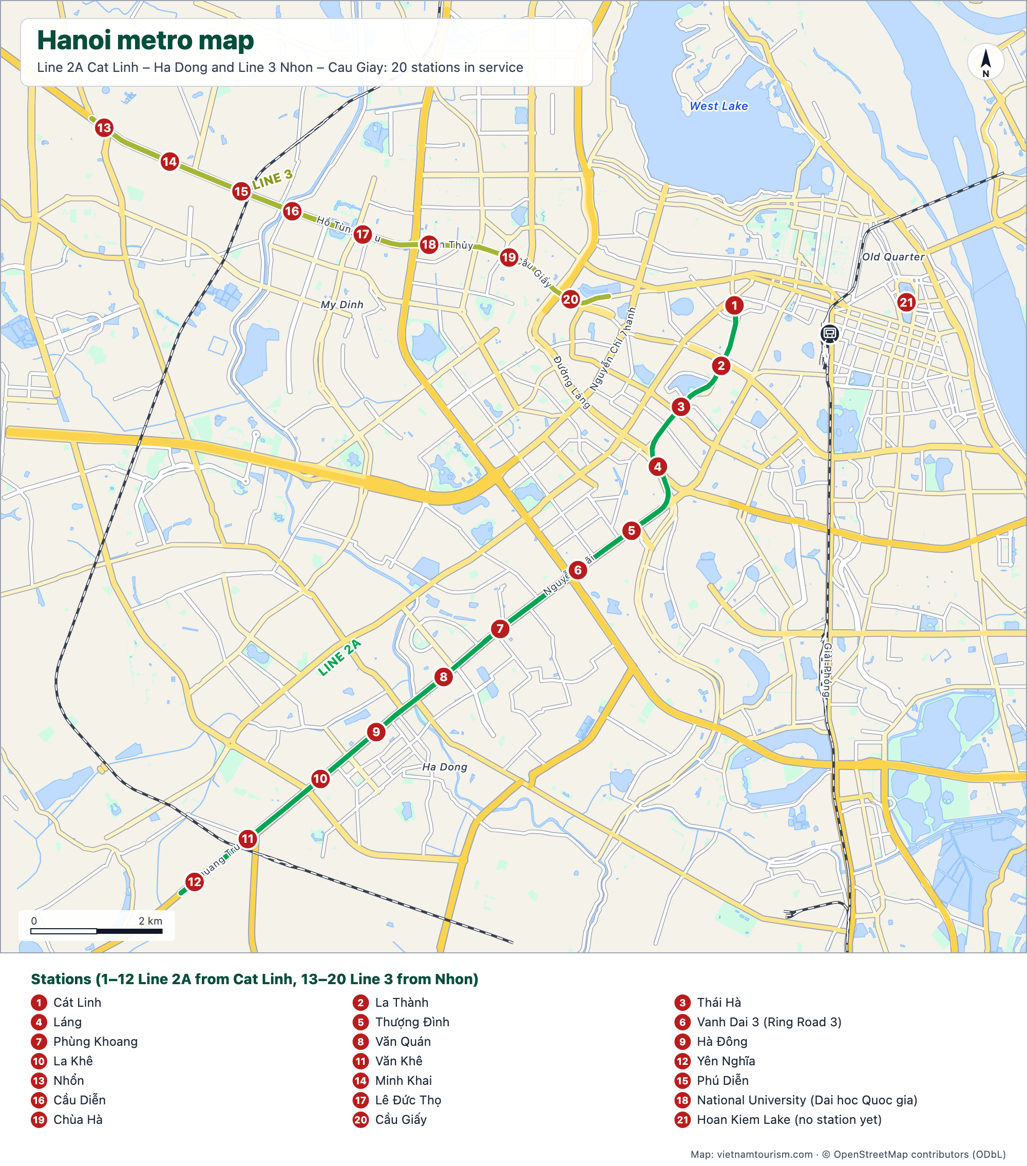
What's on the map
- 1Cát Linh
- 2La Thành
- 3Thái Hà
- 4Láng
- 5Thượng Đình
- 6Vanh Dai 3 (Ring Road 3)
- 7Phùng Khoang
- 8Văn Quán
- 9Hà Đông
- 10La Khê
- 11Văn Khê
- 12Yên Nghĩa
- 13Nhổn
- 14Minh Khai
- 15Phú Diễn
- 16Cầu Diễn
- 17Lê Đức Thọ
- 18National University (Dai hoc Quoc gia)
- 19Chùa Hà
- 20Cầu Giấy
- 21Hoan Kiem Lake (no station yet)
Other maps
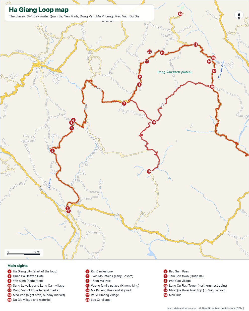
Ha Giang Loop map
Free printable map of the Ha Giang Loop: Ha Giang, Quan Ba, Yen Minh, Dong Van, Ma Pi Leng, Meo Vac, Du Gia, with the route highlighted, 20 numbered stops and the roads. PDF, PNG and SVG.
PDF · PNG · SVG
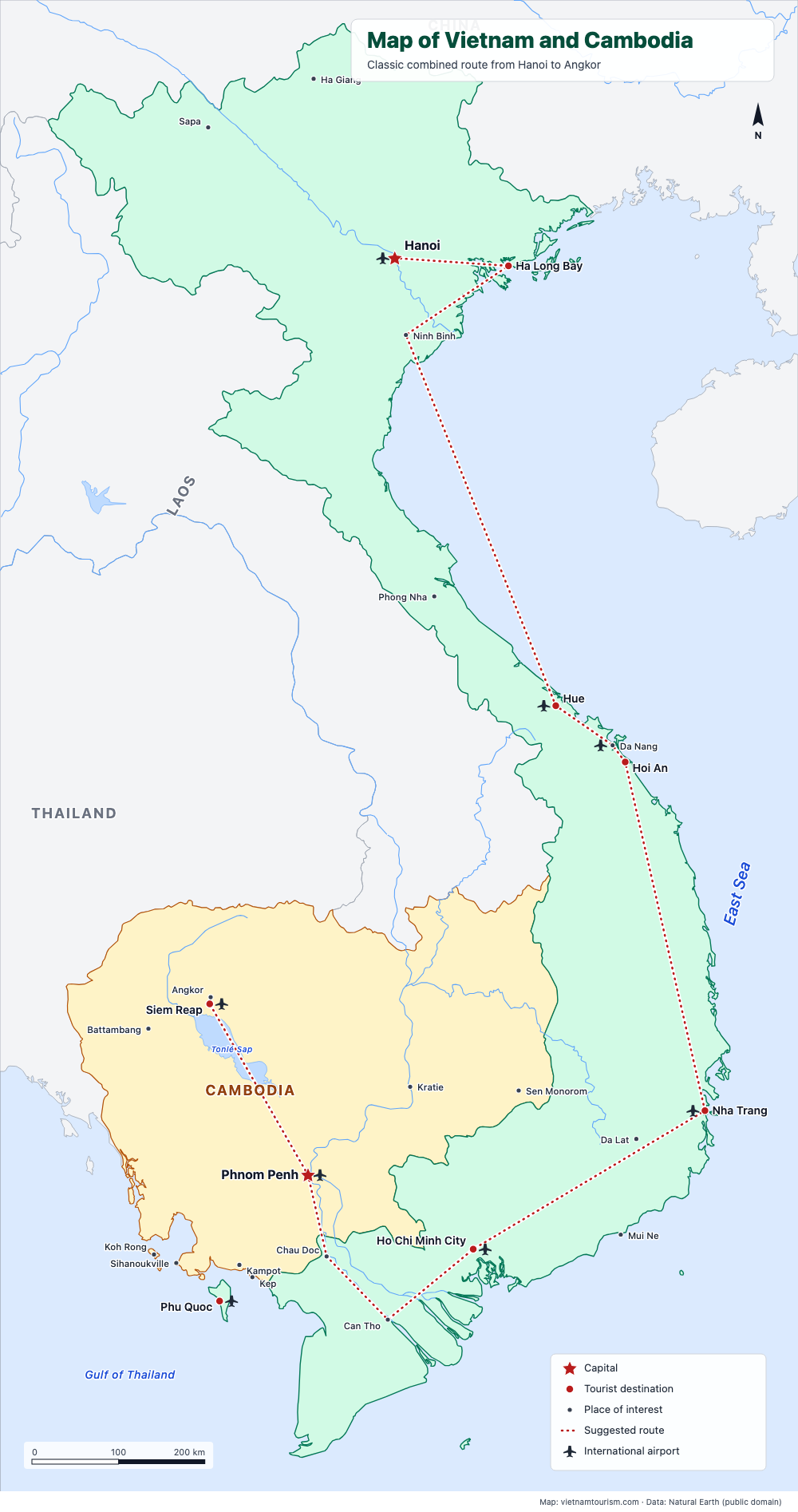
Map of Vietnam and Cambodia
Free printable map of Vietnam and Cambodia for a combined trip: Hanoi, Ha Long, Hue, Hoi An, Nha Trang, Saigon, Mekong, Phnom Penh, Siem Reap and Angkor, with the classic route drawn. PDF, PNG and SVG.
PDF · PNG · SVG
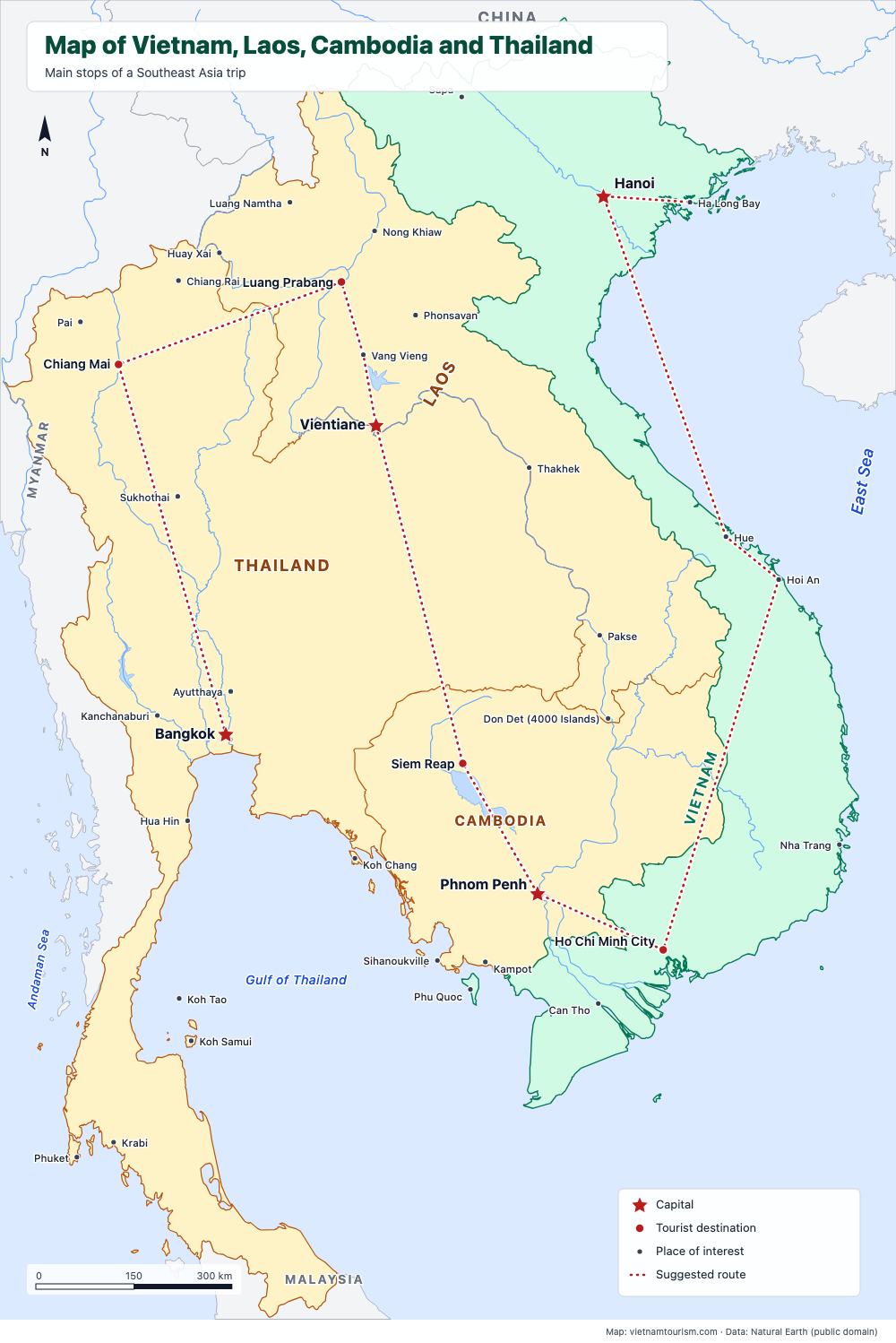
Map of Vietnam, Laos, Cambodia and Thailand
Free printable map of Vietnam, Laos, Cambodia and Thailand for a Southeast Asia trip: Bangkok, Chiang Mai, Luang Prabang, Vientiane, Siem Reap, Phnom Penh, Saigon, Hoi An, Hue, Hanoi, with a suggested route. PDF, PNG and SVG.
PDF · PNG · SVG
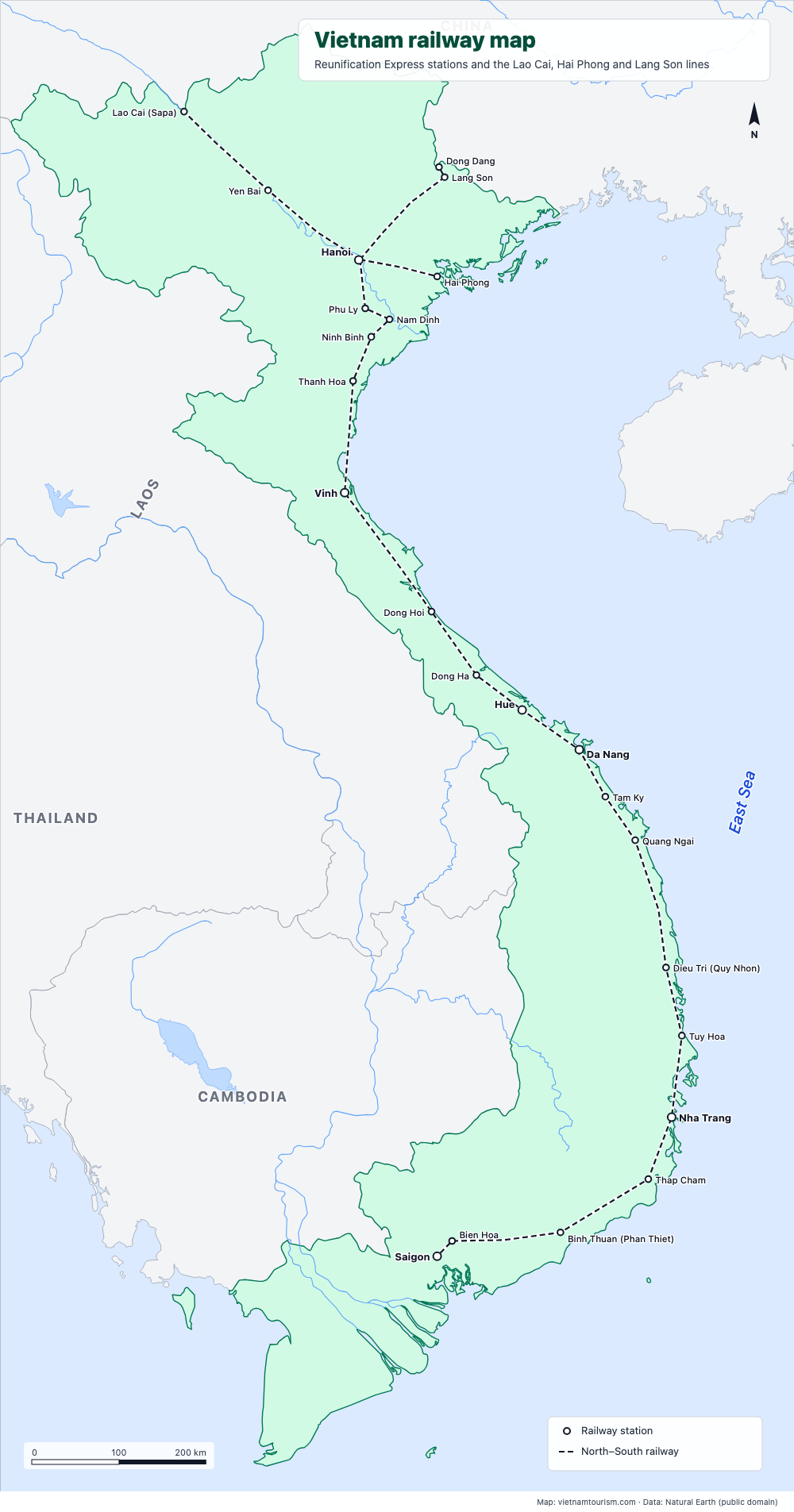
Vietnam railway map
Free printable railway map of Vietnam: the North–South line from Hanoi to Saigon with its 19 main stations, and the lines to Lao Cai (Sapa), Hai Phong and Lang Son. PDF, PNG and SVG.
PDF · PNG · SVG
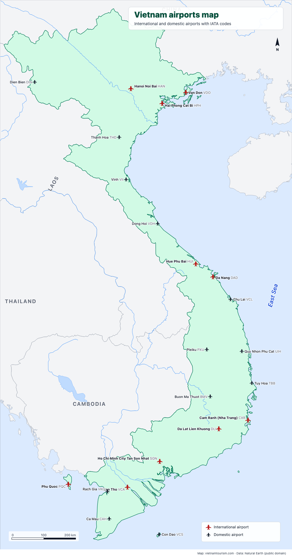
Vietnam airports map
Free printable map of Vietnam's airports: the 10 international airports (Hanoi, Ho Chi Minh City, Da Nang, Cam Ranh, Phu Quoc, Hue, Hai Phong, Van Don, Da Lat, Can Tho) and 12 domestic ones, with IATA codes. PDF, PNG and SVG.
PDF · PNG · SVG
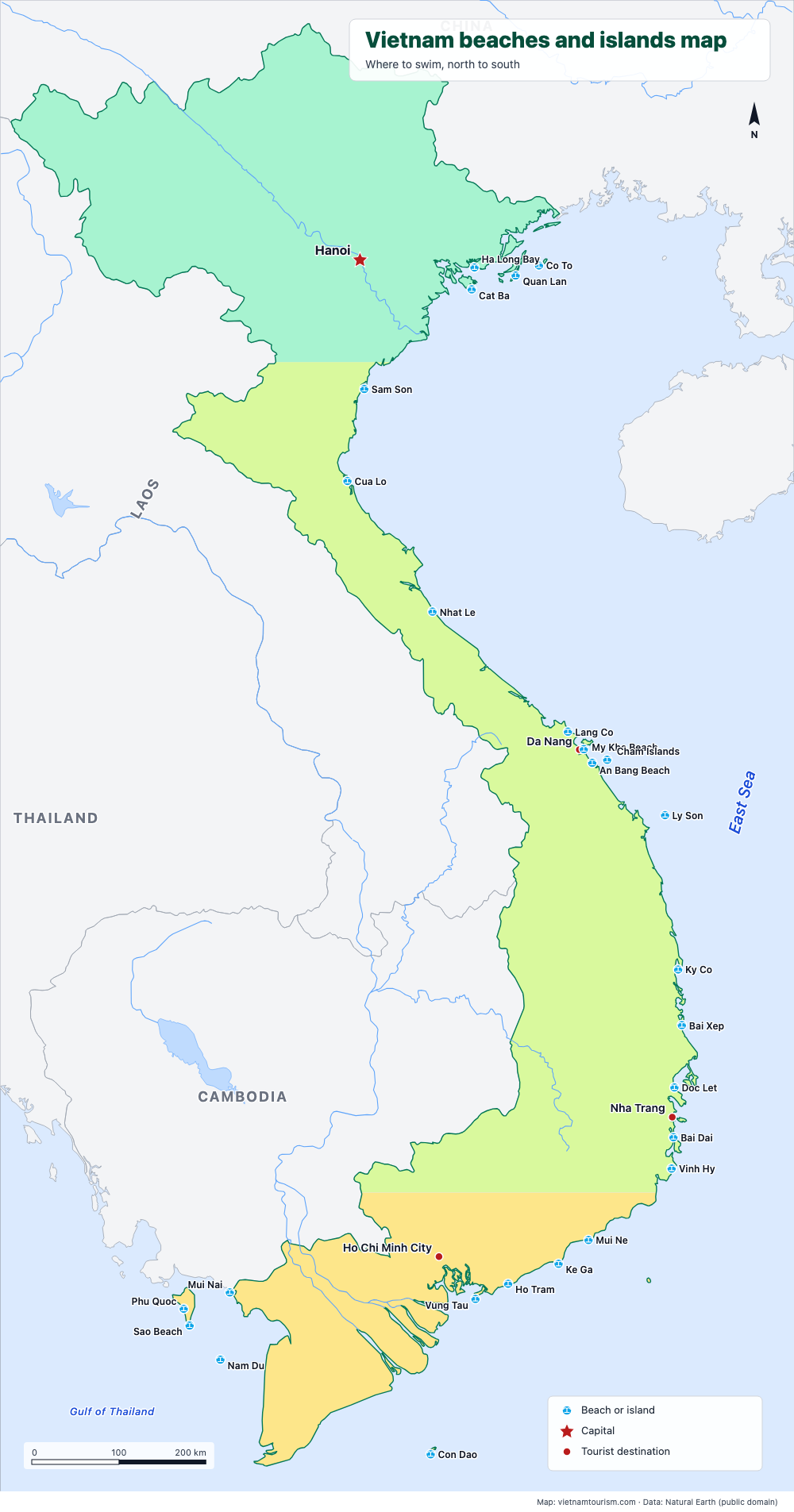
Vietnam beaches and islands map
Free printable map of Vietnam's beaches and islands: Cat Ba, Lang Co, My Khe, An Bang, Ly Son, Quy Nhon, Nha Trang, Mui Ne, Con Dao, Phu Quoc, Nam Du and 15 more, north to south. PDF, PNG and SVG.
PDF · PNG · SVG