Map of Vietnam, Laos, Cambodia and Thailand
The four countries of the classic Indochina circuit on one page, with a suggested overland route from Bangkok to Ha Long Bay through Chiang Mai, Luang Prabang, Vientiane, Siem Reap, Phnom Penh and Saigon. Thirty-six places, from the islands of the Gulf of Thailand to the mountains of Laos, to decide where to start and where to end.


Free for personal use · PDF · PNG · SVG
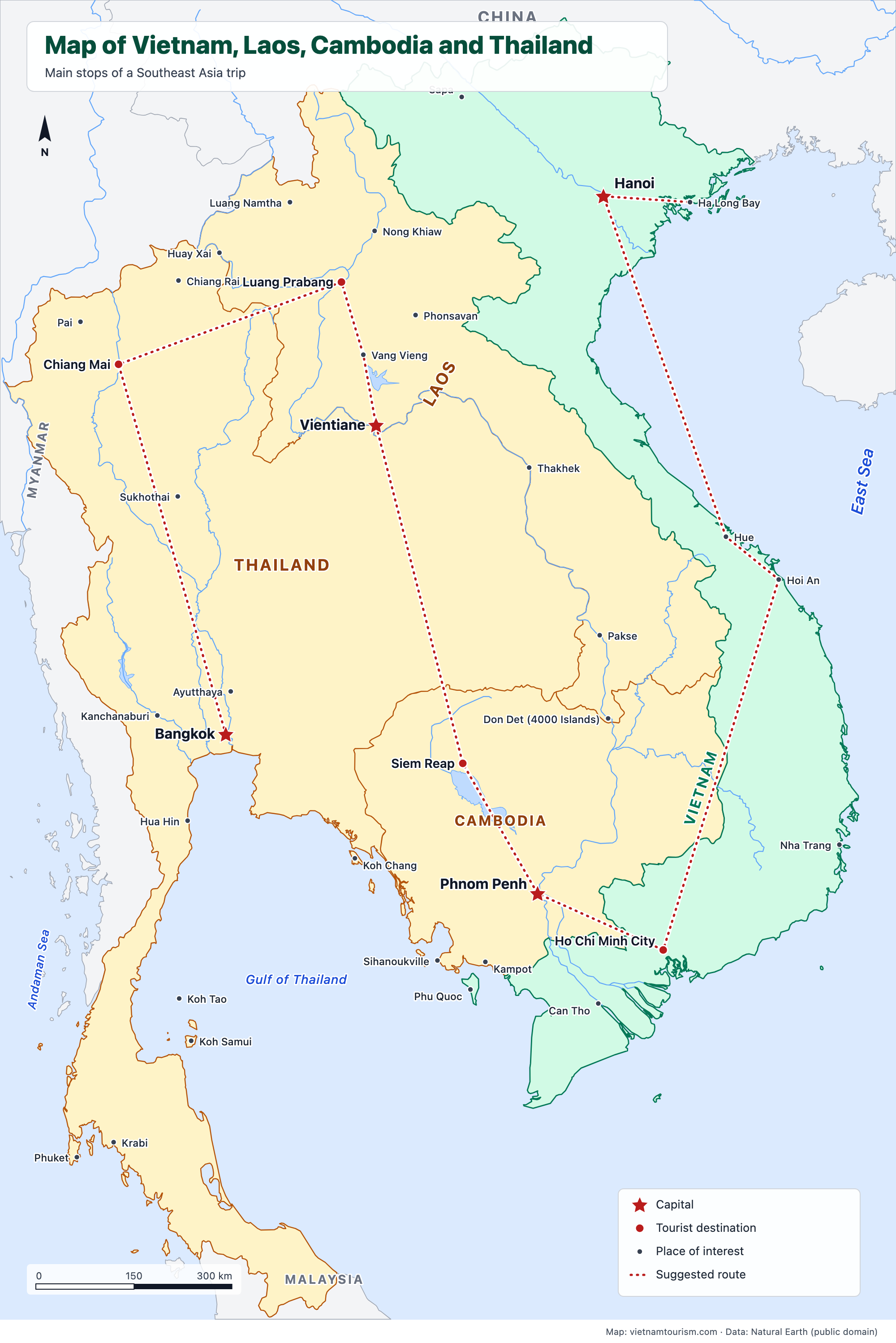
What's on the map
- Hanoi
- Ha Long Bay
- Sapa
- Hue
- Hoi An
- Nha Trang
- Ho Chi Minh City
- Can Tho
- Phu Quoc
- Phnom Penh
- Siem Reap
- Sihanoukville
- Kampot
- Vientiane
- Luang Prabang
- Vang Vieng
- Nong Khiaw
- Phonsavan
- Thakhek
- Pakse
- Don Det (4000 Islands)
- Luang Namtha
- Huay Xai
- Bangkok
- Ayutthaya
- Kanchanaburi
- Sukhothai
- Chiang Mai
- Pai
- Chiang Rai
- Hua Hin
- Koh Chang
- Koh Samui
- Koh Tao
- Krabi
- Phuket
Other maps
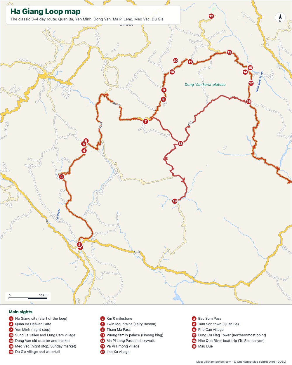
Ha Giang Loop map
Free printable map of the Ha Giang Loop: Ha Giang, Quan Ba, Yen Minh, Dong Van, Ma Pi Leng, Meo Vac, Du Gia, with the route highlighted, 20 numbered stops and the roads. PDF, PNG and SVG.
PDF · PNG · SVG
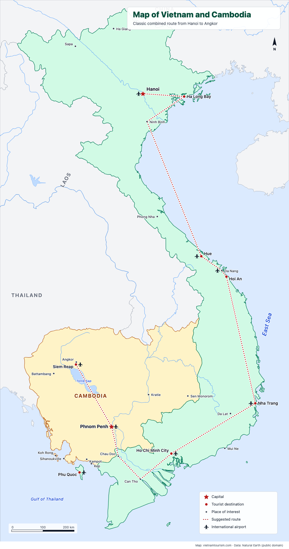
Map of Vietnam and Cambodia
Free printable map of Vietnam and Cambodia for a combined trip: Hanoi, Ha Long, Hue, Hoi An, Nha Trang, Saigon, Mekong, Phnom Penh, Siem Reap and Angkor, with the classic route drawn. PDF, PNG and SVG.
PDF · PNG · SVG
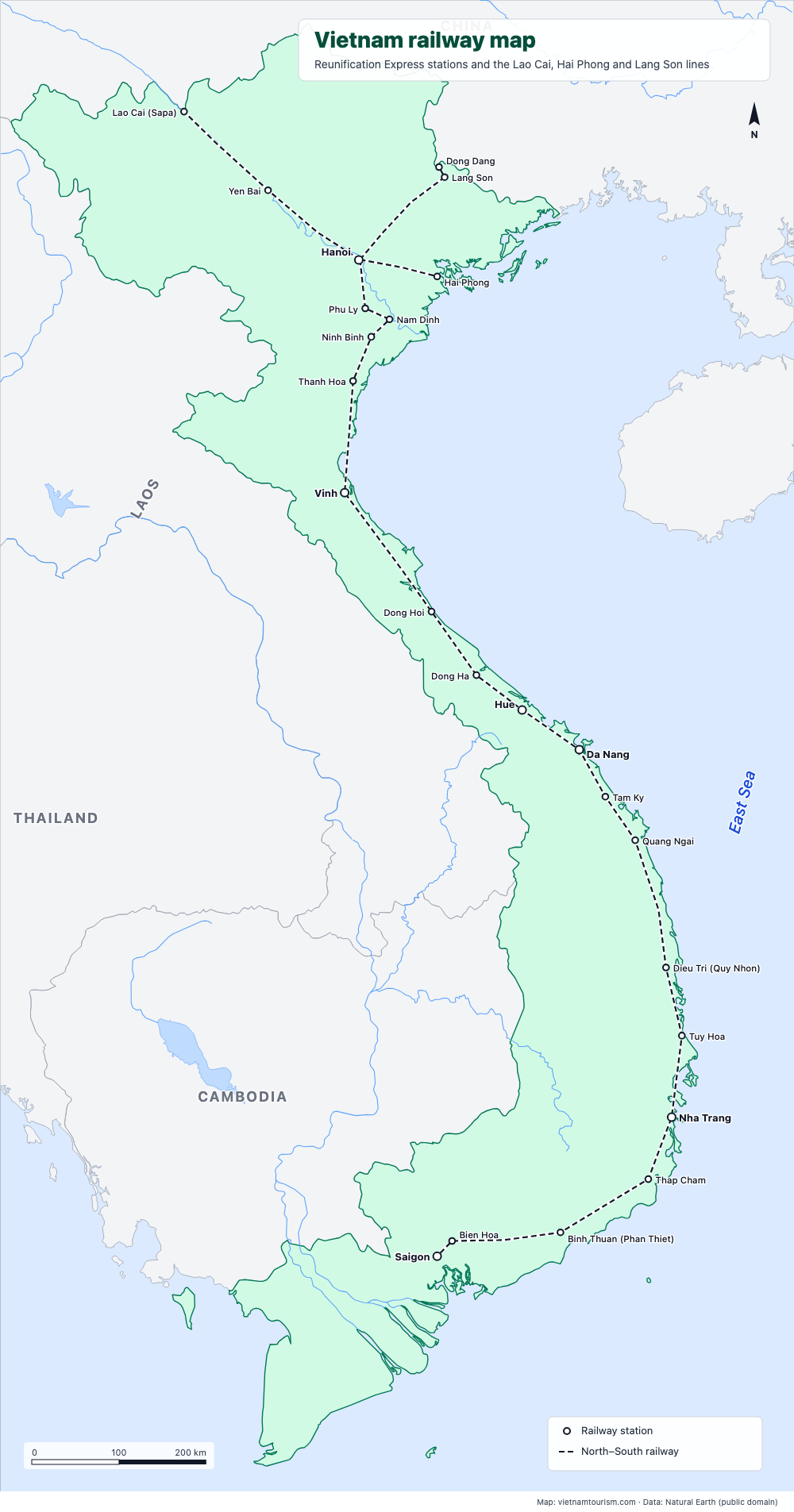
Vietnam railway map
Free printable railway map of Vietnam: the North–South line from Hanoi to Saigon with its 19 main stations, and the lines to Lao Cai (Sapa), Hai Phong and Lang Son. PDF, PNG and SVG.
PDF · PNG · SVG
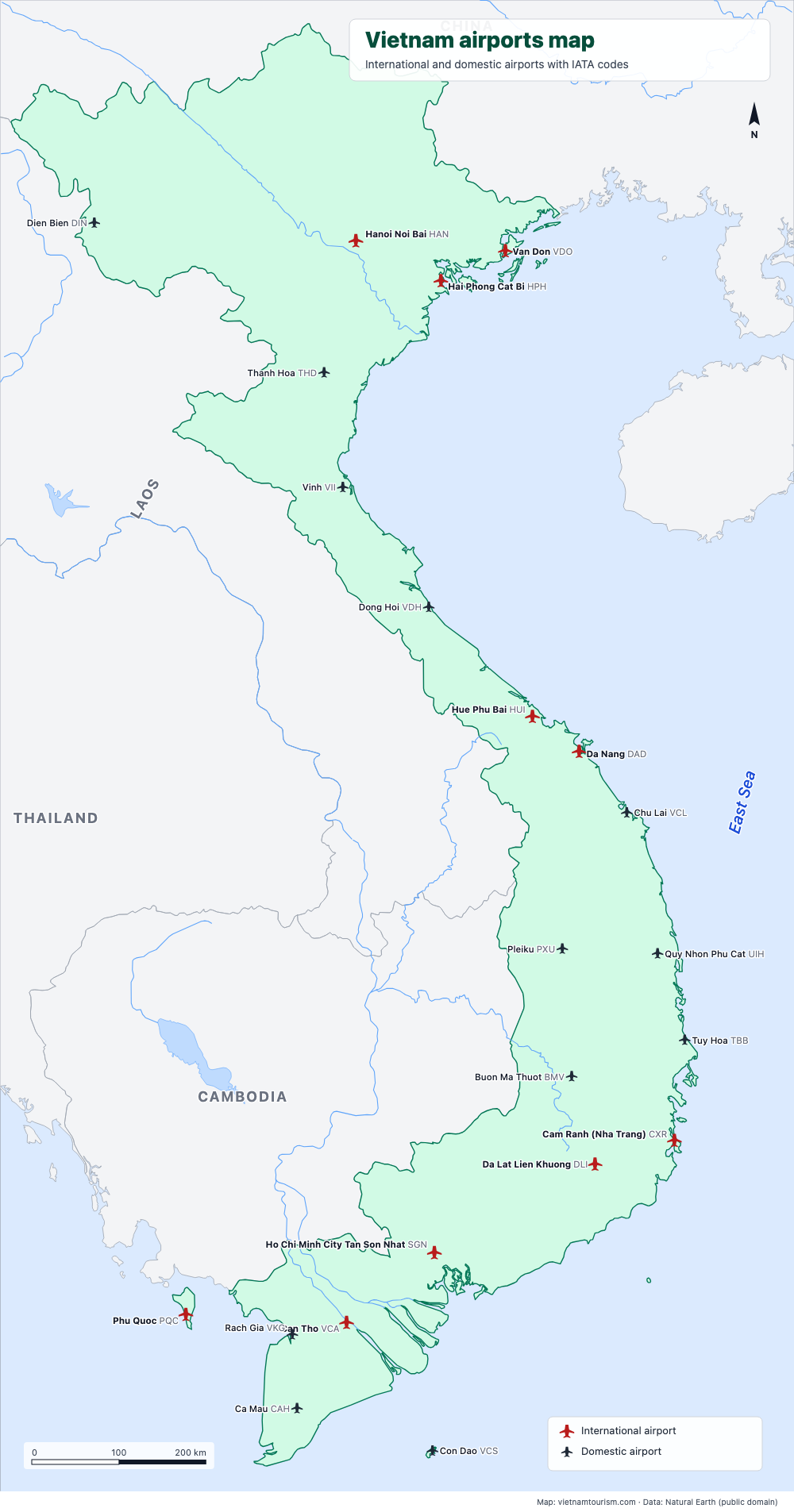
Vietnam airports map
Free printable map of Vietnam's airports: the 10 international airports (Hanoi, Ho Chi Minh City, Da Nang, Cam Ranh, Phu Quoc, Hue, Hai Phong, Van Don, Da Lat, Can Tho) and 12 domestic ones, with IATA codes. PDF, PNG and SVG.
PDF · PNG · SVG
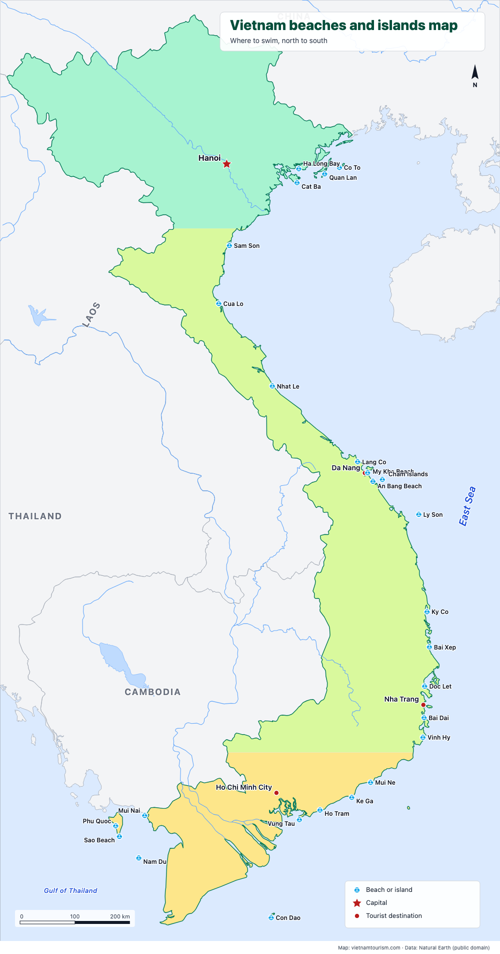
Vietnam beaches and islands map
Free printable map of Vietnam's beaches and islands: Cat Ba, Lang Co, My Khe, An Bang, Ly Son, Quy Nhon, Nha Trang, Mui Ne, Con Dao, Phu Quoc, Nam Du and 15 more, north to south. PDF, PNG and SVG.
PDF · PNG · SVG
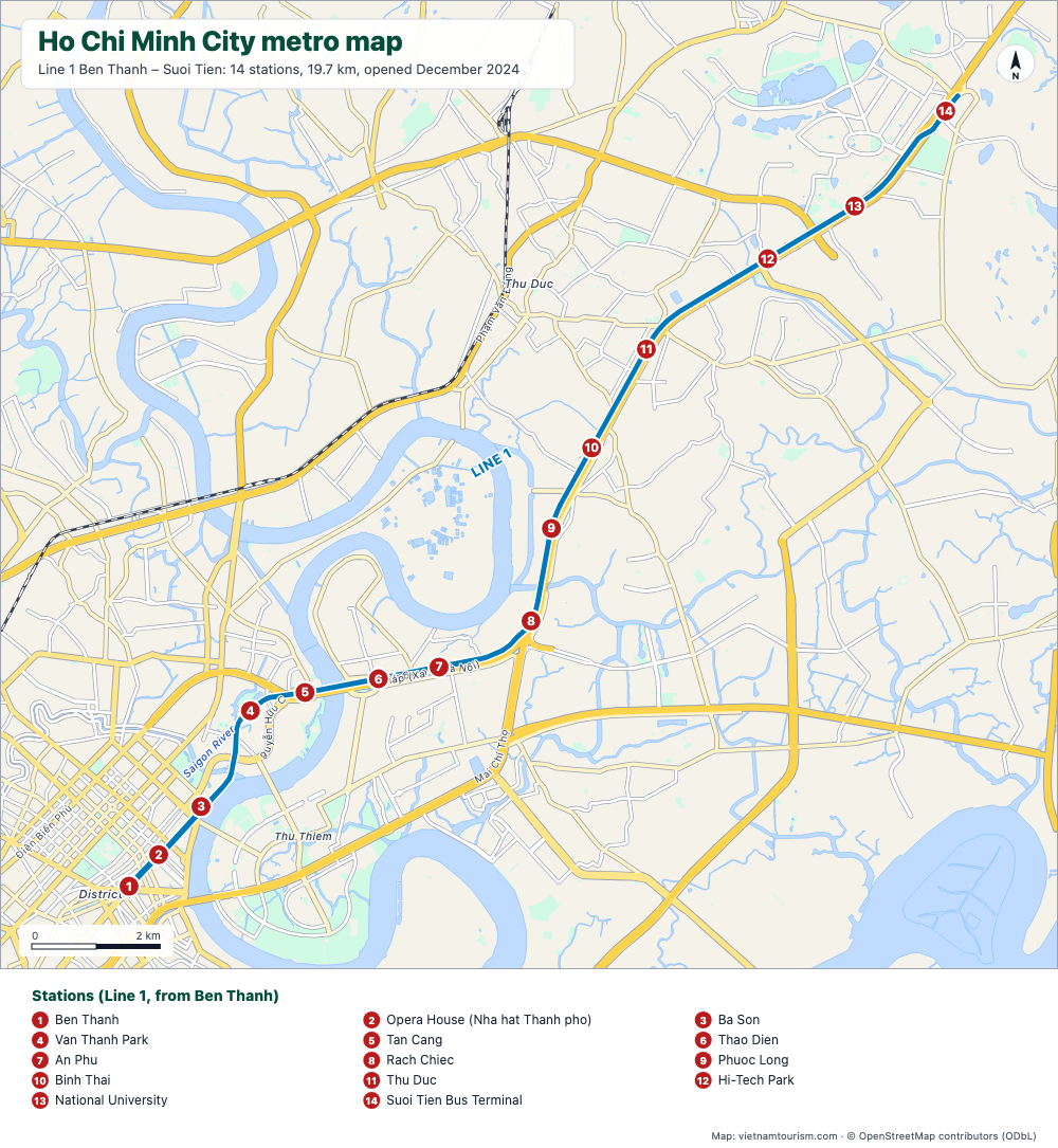
Ho Chi Minh City metro map
Free printable map of the Ho Chi Minh City metro: Line 1 Ben Thanh – Suoi Tien, 14 stations, opened in December 2024, with the main roads and the Saigon River. PDF, PNG and SVG.
PDF · PNG · SVG