Vietnam airports map
All 22 civil airports with their IATA codes: the international gateways in red, from Noi Bai and Tan Son Nhat to the beach airports of Cam Ranh and Phu Quoc, and the domestic airports in grey that save a night on the bus, such as Dong Hoi for Phong Nha, Pleiku for the Central Highlands or Con Dao. Use it with the railway map to plan internal hops.


Free for personal use · PDF · PNG · SVG
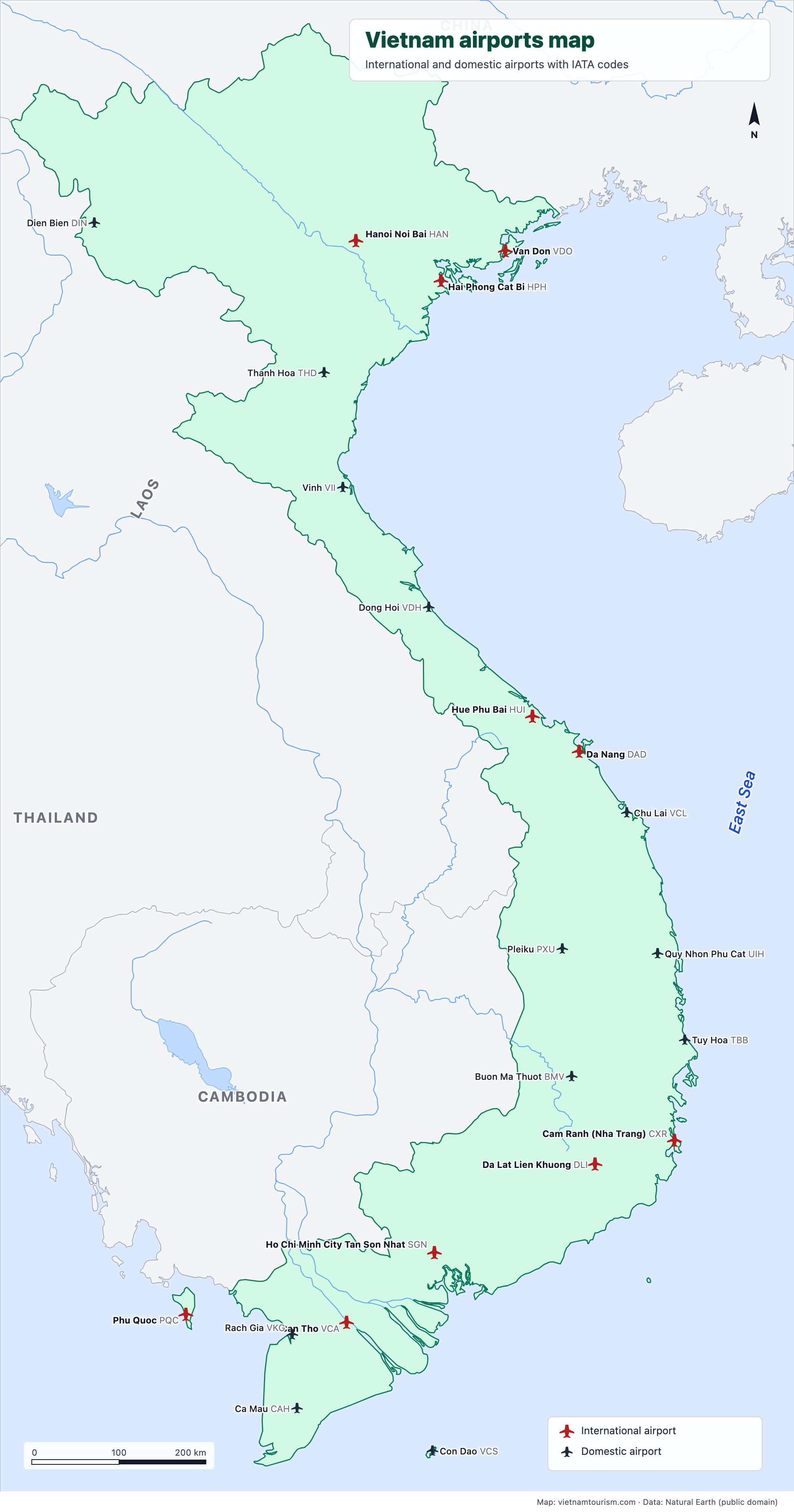
What's on the map
- Hanoi Noi Bai (HAN)
- Hai Phong Cat Bi (HPH)
- Van Don (VDO)
- Dien Bien (DIN)
- Thanh Hoa (THD)
- Vinh (VII)
- Dong Hoi (VDH)
- Hue Phu Bai (HUI)
- Da Nang (DAD)
- Chu Lai (VCL)
- Quy Nhon Phu Cat (UIH)
- Tuy Hoa (TBB)
- Pleiku (PXU)
- Buon Ma Thuot (BMV)
- Cam Ranh (Nha Trang) (CXR)
- Da Lat Lien Khuong (DLI)
- Ho Chi Minh City Tan Son Nhat (SGN)
- Con Dao (VCS)
- Can Tho (VCA)
- Phu Quoc (PQC)
- Rach Gia (VKG)
- Ca Mau (CAH)
Other maps
Ha Giang Loop map
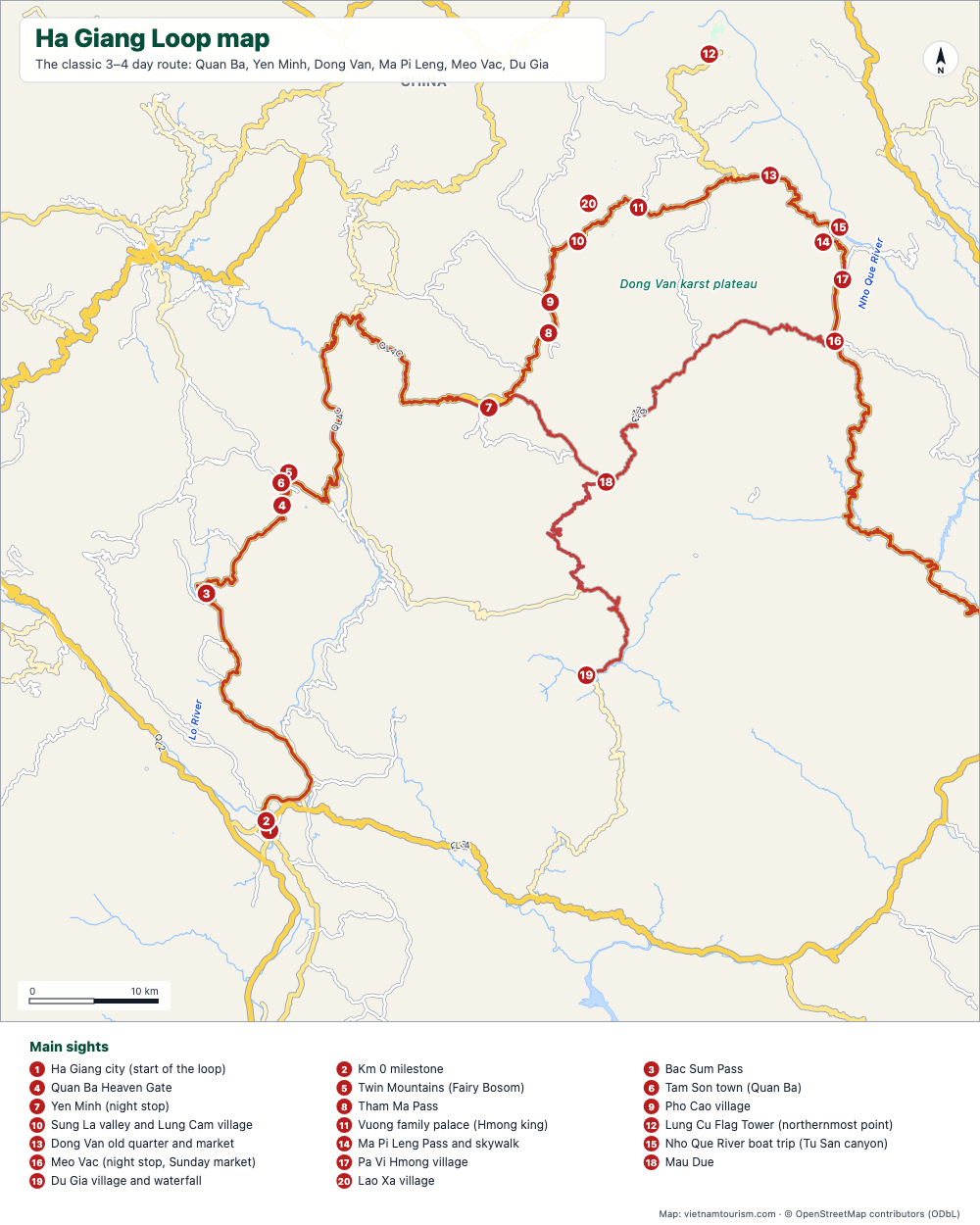
Free printable map of the Ha Giang Loop: Ha Giang, Quan Ba, Yen Minh, Dong Van, Ma Pi Leng, Meo Vac, Du Gia, with the route highlighted, 20 numbered stops and the roads. PDF, PNG and SVG.
PDF · PNG · SVG
Map of Vietnam and Cambodia
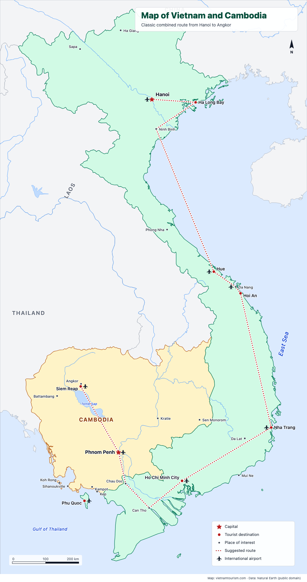
Free printable map of Vietnam and Cambodia for a combined trip: Hanoi, Ha Long, Hue, Hoi An, Nha Trang, Saigon, Mekong, Phnom Penh, Siem Reap and Angkor, with the classic route drawn. PDF, PNG and SVG.
PDF · PNG · SVG
Map of Vietnam, Laos, Cambodia and Thailand
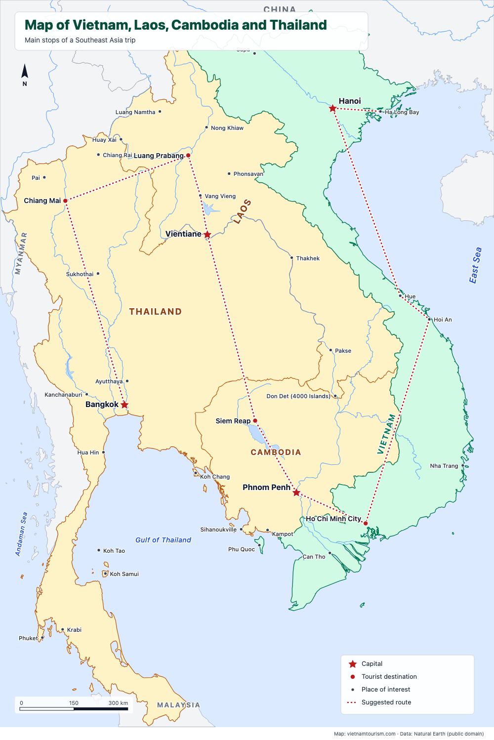
Free printable map of Vietnam, Laos, Cambodia and Thailand for a Southeast Asia trip: Bangkok, Chiang Mai, Luang Prabang, Vientiane, Siem Reap, Phnom Penh, Saigon, Hoi An, Hue, Hanoi, with a suggested route. PDF, PNG and SVG.
PDF · PNG · SVG
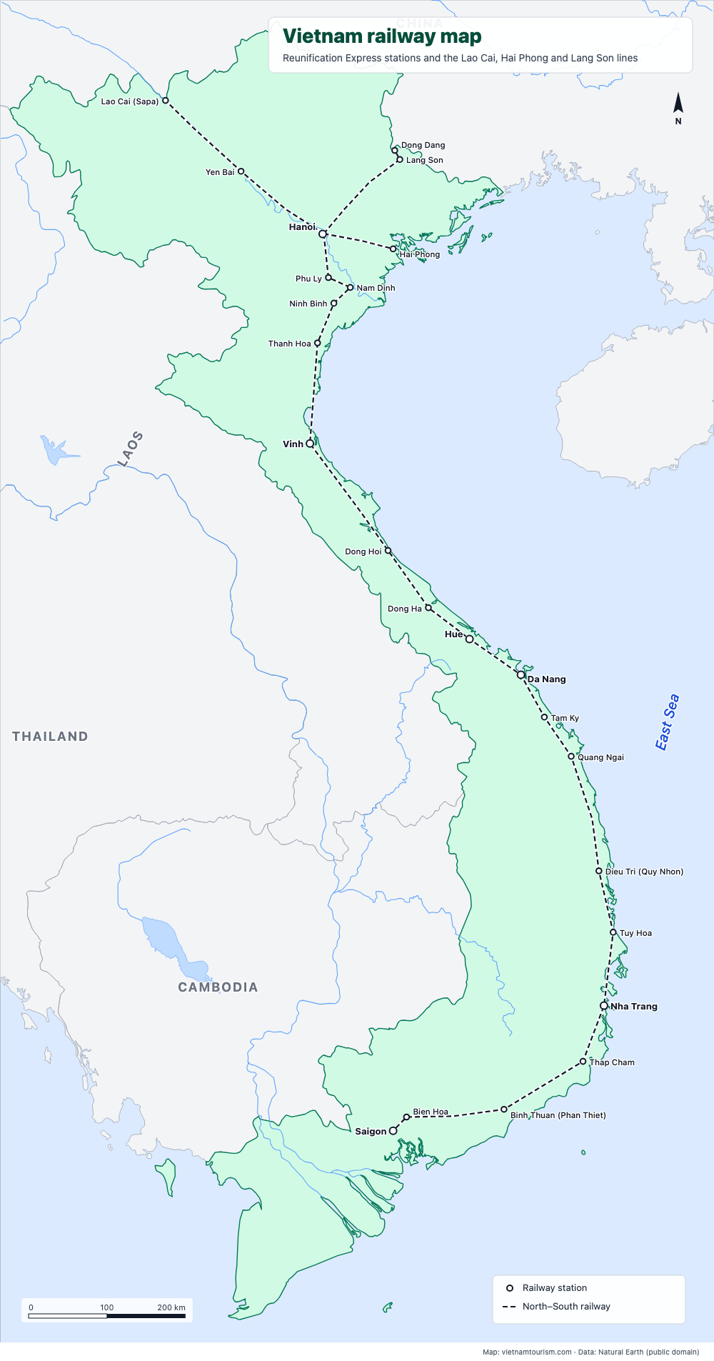
Vietnam railway map
Free printable railway map of Vietnam: the North–South line from Hanoi to Saigon with its 19 main stations, and the lines to Lao Cai (Sapa), Hai Phong and Lang Son. PDF, PNG and SVG.
PDF · PNG · SVG
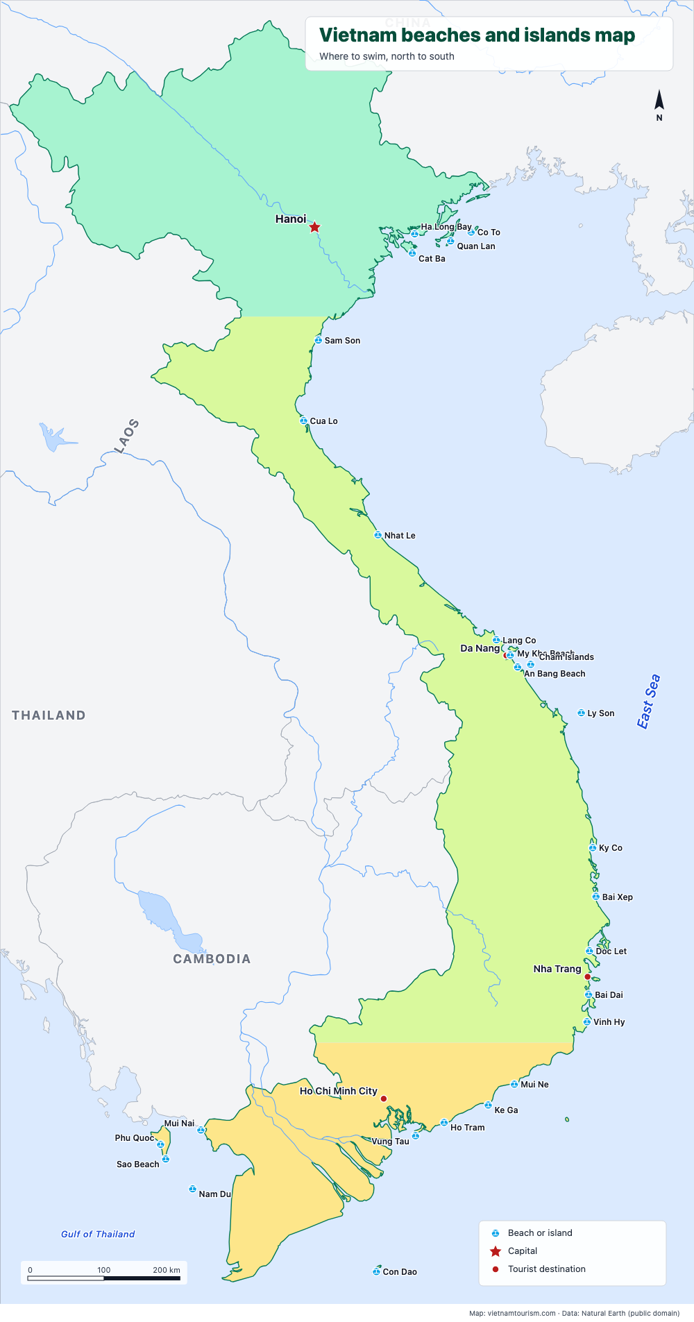
Vietnam beaches and islands map
Free printable map of Vietnam's beaches and islands: Cat Ba, Lang Co, My Khe, An Bang, Ly Son, Quy Nhon, Nha Trang, Mui Ne, Con Dao, Phu Quoc, Nam Du and 15 more, north to south. PDF, PNG and SVG.
PDF · PNG · SVG
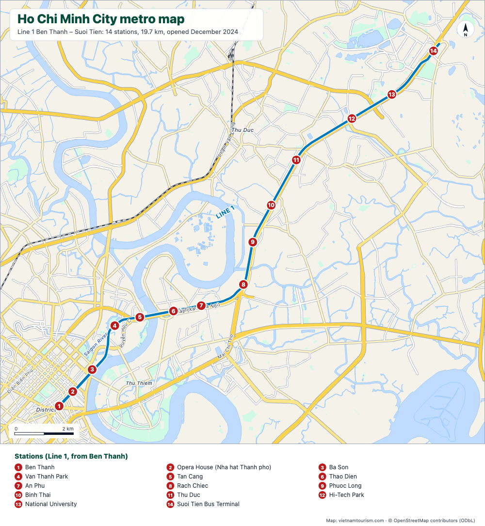
Ho Chi Minh City metro map
Free printable map of the Ho Chi Minh City metro: Line 1 Ben Thanh – Suoi Tien, 14 stations, opened in December 2024, with the main roads and the Saigon River. PDF, PNG and SVG.
PDF · PNG · SVG