Cao Bang Loop map
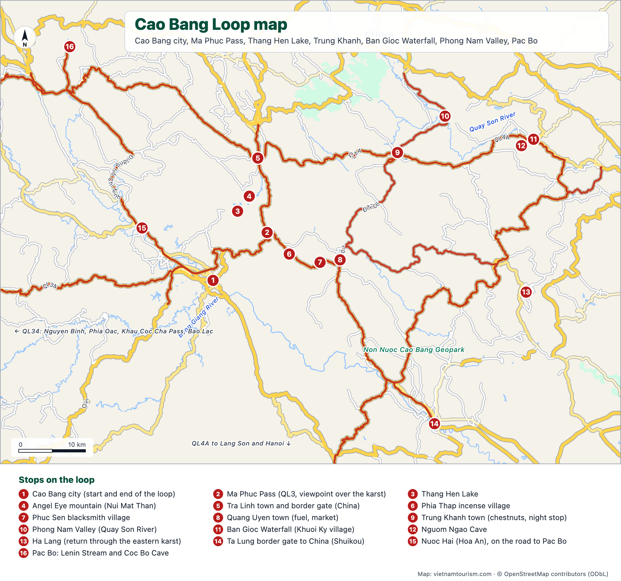
The Cao Bang Loop on one page: the QL3 road east from Cao Bang city over the Ma Phuc Pass to Quang Uyen and Trung Khanh, Ban Gioc Waterfall and Nguom Ngao Cave on the Chinese border, the Phong Nam Valley, Thang Hen Lake and the Angel Eye mountain, and the road north to Pac Bo. The main roads are highlighted and the numbered stops cover the 2-day classic route and its 3-day extension, with the border gates and the road west towards Bao Lac and the Ha Giang Loop.


Free for personal use · PDF · PNG · SVG
What's on the map
- 1Cao Bang city (start and end of the loop)
- 2Ma Phuc Pass (QL3, viewpoint over the karst)
- 3Thang Hen Lake
- 4Angel Eye mountain (Nui Mat Than)
- 5Tra Linh town and border gate (China)
- 6Phia Thap incense village
- 7Phuc Sen blacksmith village
- 8Quang Uyen town (fuel, market)
- 9Trung Khanh town (chestnuts, night stop)
- 10Phong Nam Valley (Quay Son River)
- 11Ban Gioc Waterfall (Khuoi Ky village)
- 12Nguom Ngao Cave
- 13Ha Lang (return through the eastern karst)
- 14Ta Lung border gate to China (Shuikou)
- 15Nuoc Hai (Hoa An), on the road to Pac Bo
- 16Pac Bo: Lenin Stream and Coc Bo Cave
Other maps
Ha Giang Loop map
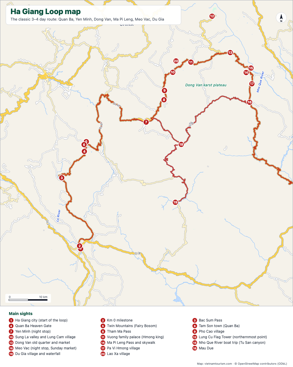
Free printable map of the Ha Giang Loop: Ha Giang, Quan Ba, Yen Minh, Dong Van, Ma Pi Leng, Meo Vac, Du Gia, with the route highlighted, 20 numbered stops and the roads. PDF, PNG and SVG.
PDF · PNG · SVG
Map of Vietnam and Cambodia
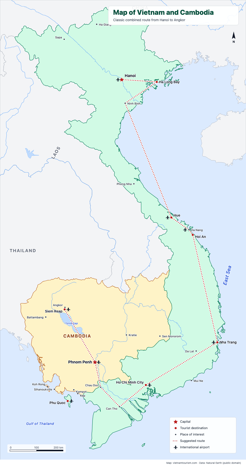
Free printable map of Vietnam and Cambodia for a combined trip: Hanoi, Ha Long, Hue, Hoi An, Nha Trang, Saigon, Mekong, Phnom Penh, Siem Reap and Angkor, with the classic route drawn. PDF, PNG and SVG.
PDF · PNG · SVG
Map of Vietnam, Laos, Cambodia and Thailand
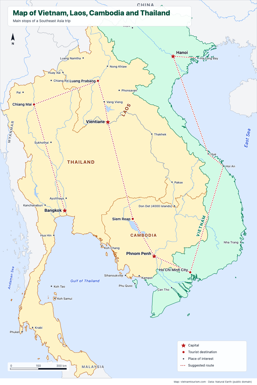
Free printable map of Vietnam, Laos, Cambodia and Thailand for a Southeast Asia trip: Bangkok, Chiang Mai, Luang Prabang, Vientiane, Siem Reap, Phnom Penh, Saigon, Hoi An, Hue, Hanoi, with a suggested route. PDF, PNG and SVG.
PDF · PNG · SVG
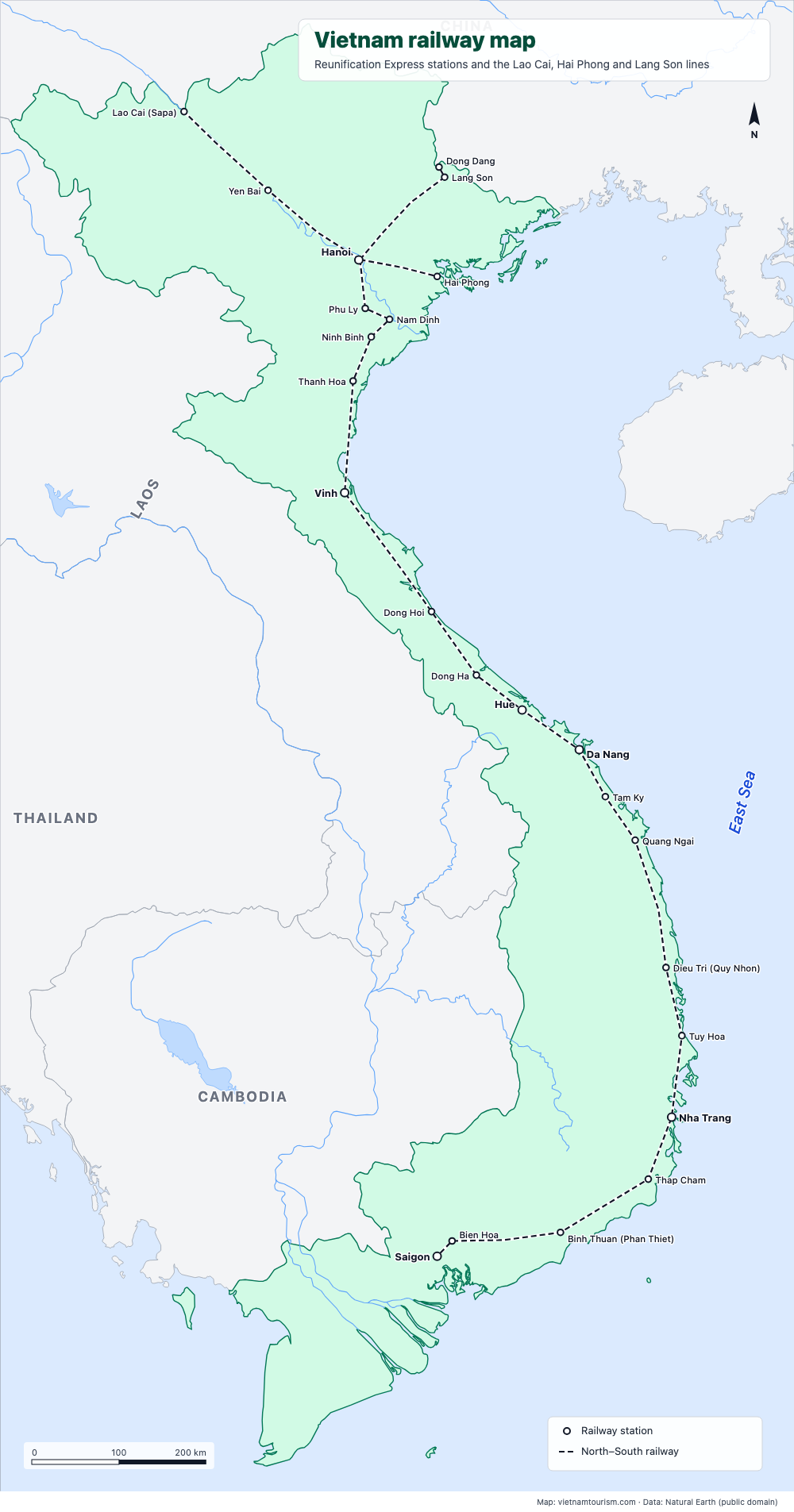
Vietnam railway map
Free printable railway map of Vietnam: the North–South line from Hanoi to Saigon with its 19 main stations, and the lines to Lao Cai (Sapa), Hai Phong and Lang Son. PDF, PNG and SVG.
PDF · PNG · SVG
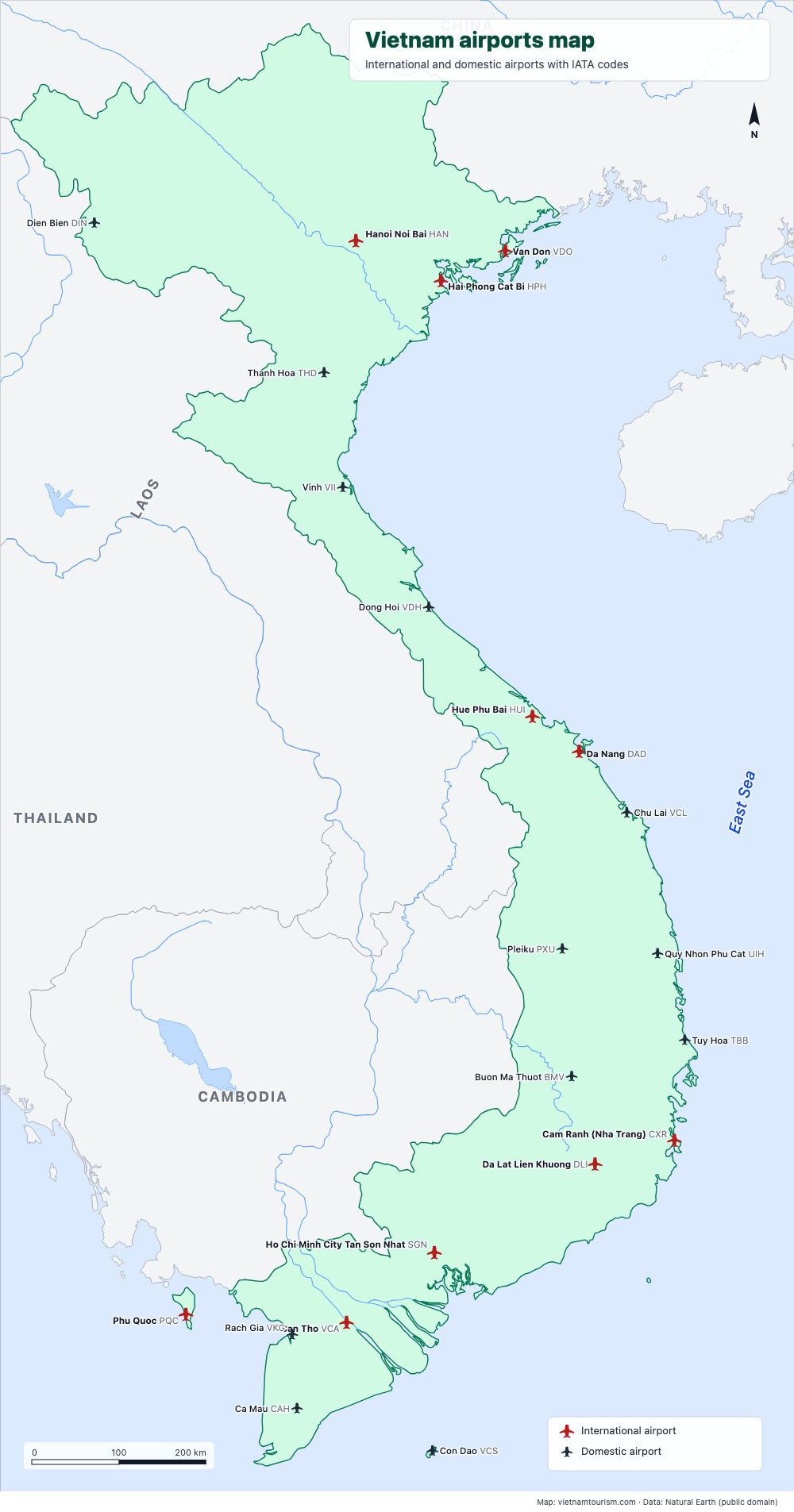
Vietnam airports map
Free printable map of Vietnam's airports: the 10 international airports (Hanoi, Ho Chi Minh City, Da Nang, Cam Ranh, Phu Quoc, Hue, Hai Phong, Van Don, Da Lat, Can Tho) and 12 domestic ones, with IATA codes. PDF, PNG and SVG.
PDF · PNG · SVG
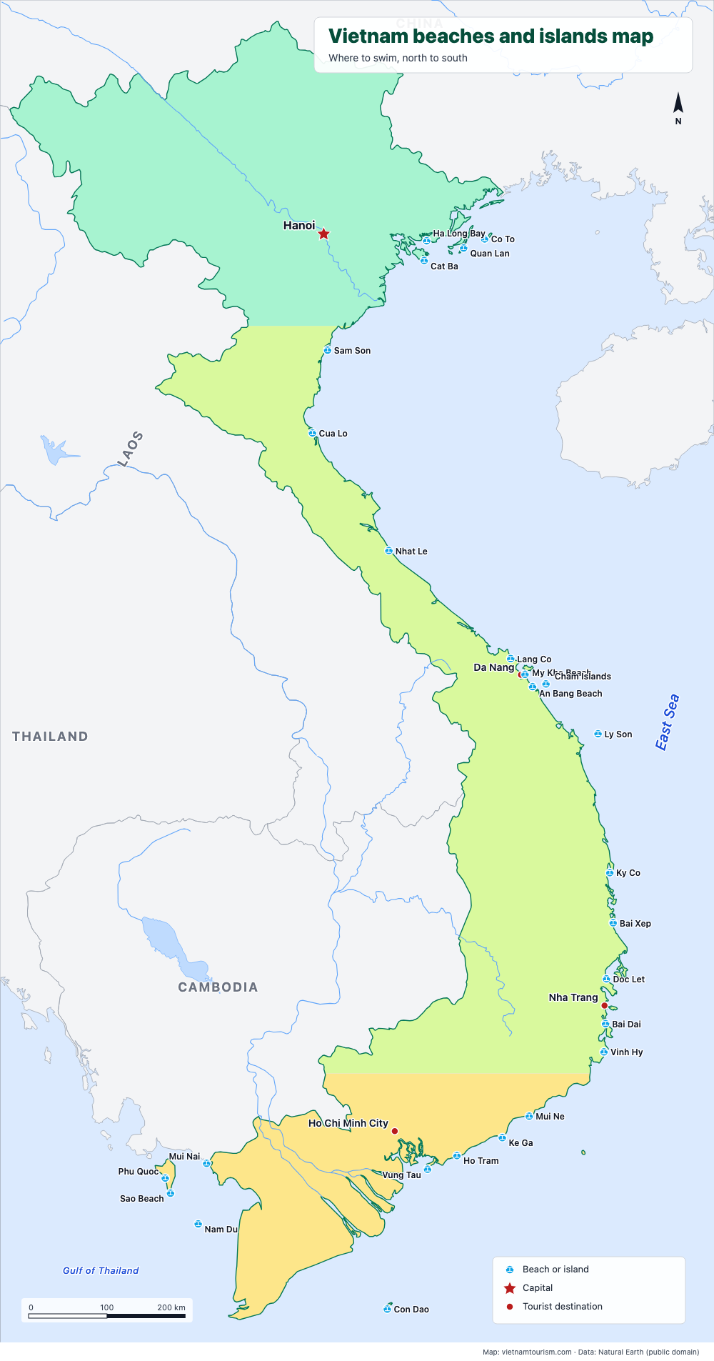
Vietnam beaches and islands map
Free printable map of Vietnam's beaches and islands: Cat Ba, Lang Co, My Khe, An Bang, Ly Son, Quy Nhon, Nha Trang, Mui Ne, Con Dao, Phu Quoc, Nam Du and 15 more, north to south. PDF, PNG and SVG.
PDF · PNG · SVG