Phong Nha map
Phong Nha-Ke Bang on one page: the village of Phong Nha on the Son River, the boat to Phong Nha and Tien Son caves, the Ho Chi Minh Highway West to Paradise Cave, Dark Cave, the Nuoc Mooc spring and the Botanic Garden, the Bong Lai valley, and the jungle entrances of Hang En and Son Doong, reached on guided expeditions only. The map also shows the 45 km from Dong Hoi, its airport, railway station and Nhat Le beach, to plan the stopover between Ninh Binh and Hue.


Free for personal use · PDF · PNG · SVG
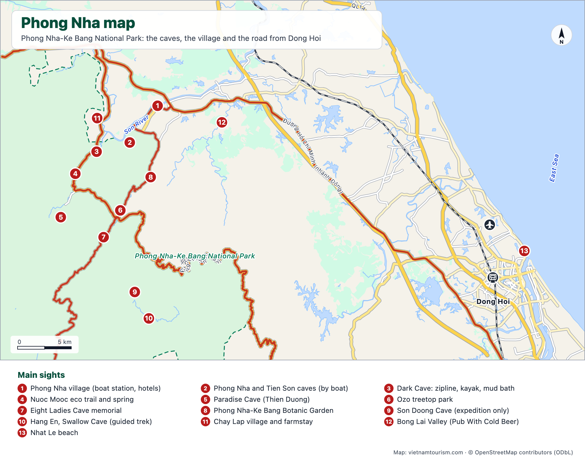
What's on the map
- 1Phong Nha village (boat station, hotels)
- 2Phong Nha and Tien Son caves (by boat)
- 3Dark Cave: zipline, kayak, mud bath
- 4Nuoc Mooc eco trail and spring
- 5Paradise Cave (Thien Duong)
- 6Ozo treetop park
- 7Eight Ladies Cave memorial
- 8Phong Nha-Ke Bang Botanic Garden
- 9Son Doong Cave (expedition only)
- 10Hang En, Swallow Cave (guided trek)
- 11Chay Lap village and farmstay
- 12Bong Lai Valley (Pub With Cold Beer)
- 13Nhat Le beach
Other maps
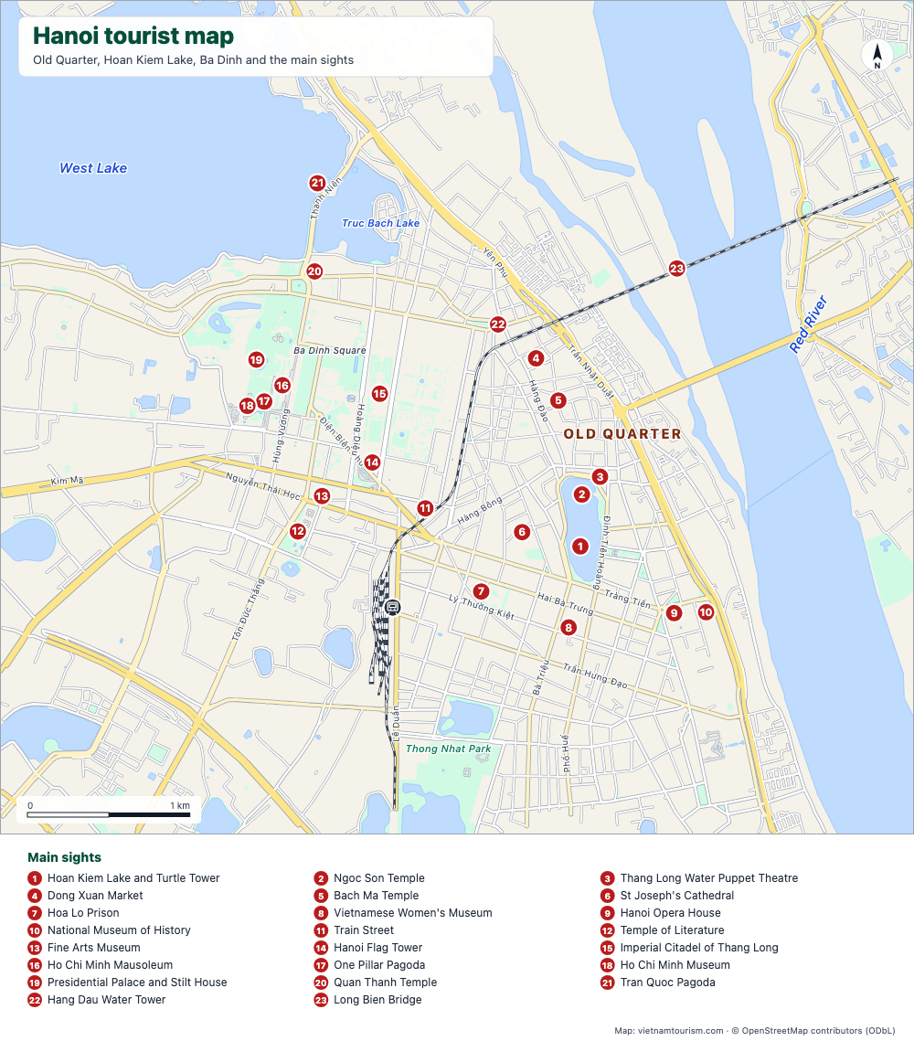
Hanoi tourist map
Free tourist map of Hanoi to print: Old Quarter, Hoan Kiem Lake, Ba Dinh, 23 numbered sights, main streets and the train station. PDF, PNG and SVG.
PDF · PNG · SVG
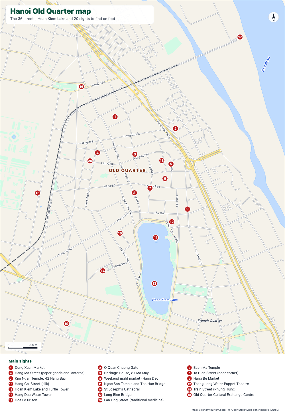
Hanoi Old Quarter map
Free printable map of Hanoi's Old Quarter: the 36 guild streets with their names, Dong Xuan Market, Bach Ma Temple, Hoan Kiem Lake and 20 numbered sights. PDF, PNG and SVG.
PDF · PNG · SVG
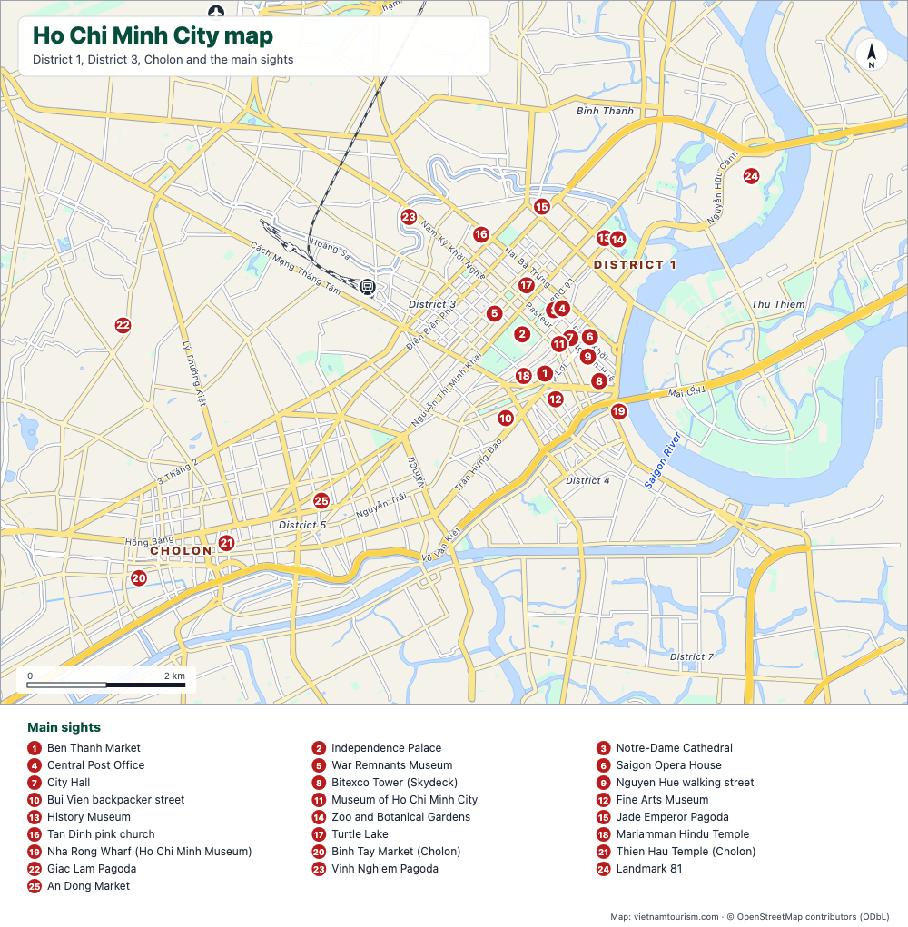
Ho Chi Minh City map
Free printable map of Ho Chi Minh City (Saigon): District 1, District 3, Cholon, Thu Thiem, 25 numbered sights, main avenues, station and airport. PDF, PNG and SVG.
PDF · PNG · SVG
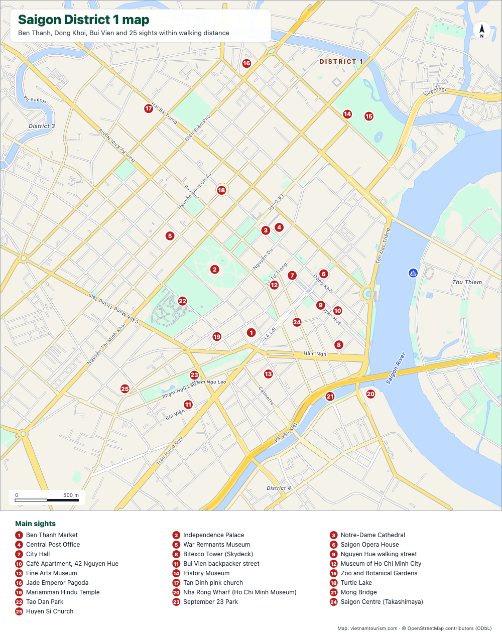
Saigon District 1 map
Free printable map of Saigon's District 1: Ben Thanh, Dong Khoi, Nguyen Hue, Bui Vien and 25 sights within walking distance, with street names. PDF, PNG and SVG.
PDF · PNG · SVG
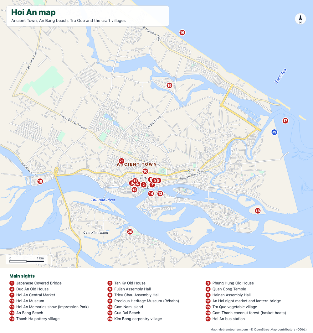
Hoi An map
Free printable map of Hoi An: the Ancient Town, An Bang and Cua Dai beaches, Tra Que, the craft villages, the Cua Dai pier and 21 numbered sights. PDF, PNG and SVG.
PDF · PNG · SVG
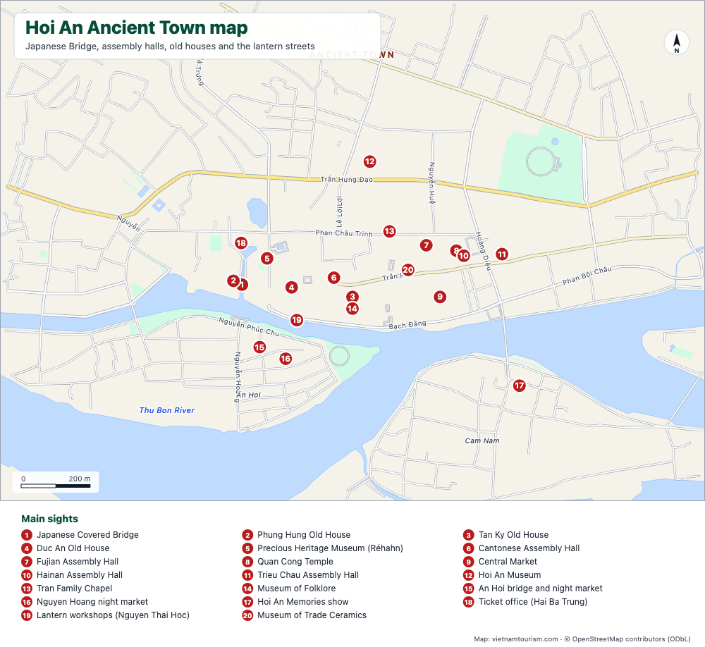
Hoi An Ancient Town map
Free printable map of Hoi An Ancient Town: Japanese Bridge, assembly halls, old houses, museums, market and lantern streets, 20 numbered sights with street names. PDF, PNG and SVG.
PDF · PNG · SVG