Da Nang map
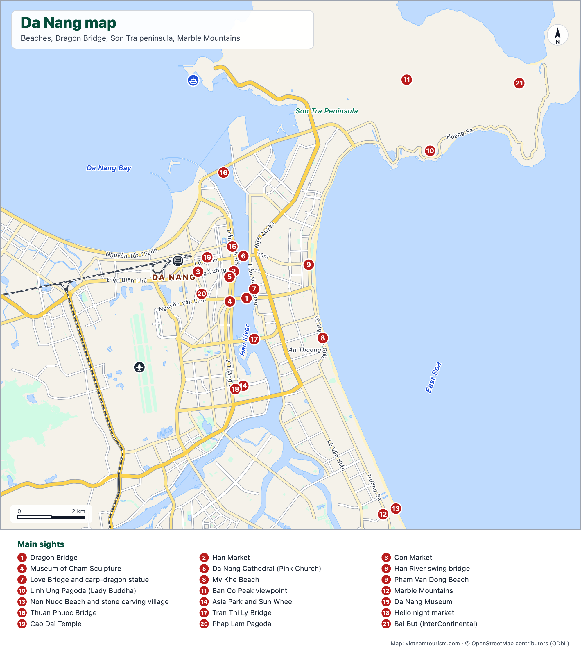
Da Nang from the airport to the Son Tra peninsula: the city centre and its bridges over the Han River, the long beach from My Khe to Non Nuoc, the Lady Buddha, Ban Co peak and the Marble Mountains to the south, 24 numbered sights with the main avenues named. Ba Na Hills and the Hai Van Pass lie off the map, to the west and north.


Free for personal use · PDF · PNG · SVG
What's on the map
- 1Dragon Bridge
- 2Han Market
- 3Con Market
- 4Museum of Cham Sculpture
- 5Da Nang Cathedral (Pink Church)
- 6Han River swing bridge
- 7Love Bridge and carp-dragon statue
- 8My Khe Beach
- 9Pham Van Dong Beach
- 10Linh Ung Pagoda (Lady Buddha)
- 11Ban Co Peak viewpoint
- 12Marble Mountains
- 13Non Nuoc Beach and stone carving village
- 14Asia Park and Sun Wheel
- 15Da Nang Museum
- 16Thuan Phuoc Bridge
- 17Tran Thi Ly Bridge
- 18Helio night market
- 19Cao Dai Temple
- 20Phap Lam Pagoda
- 21Bai But (InterContinental)
Other maps
Hanoi tourist map
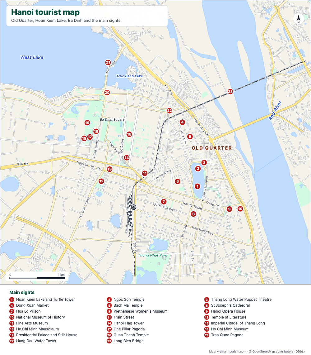
Free tourist map of Hanoi to print: Old Quarter, Hoan Kiem Lake, Ba Dinh, 23 numbered sights, main streets and the train station. PDF, PNG and SVG.
PDF · PNG · SVG
Hanoi Old Quarter map
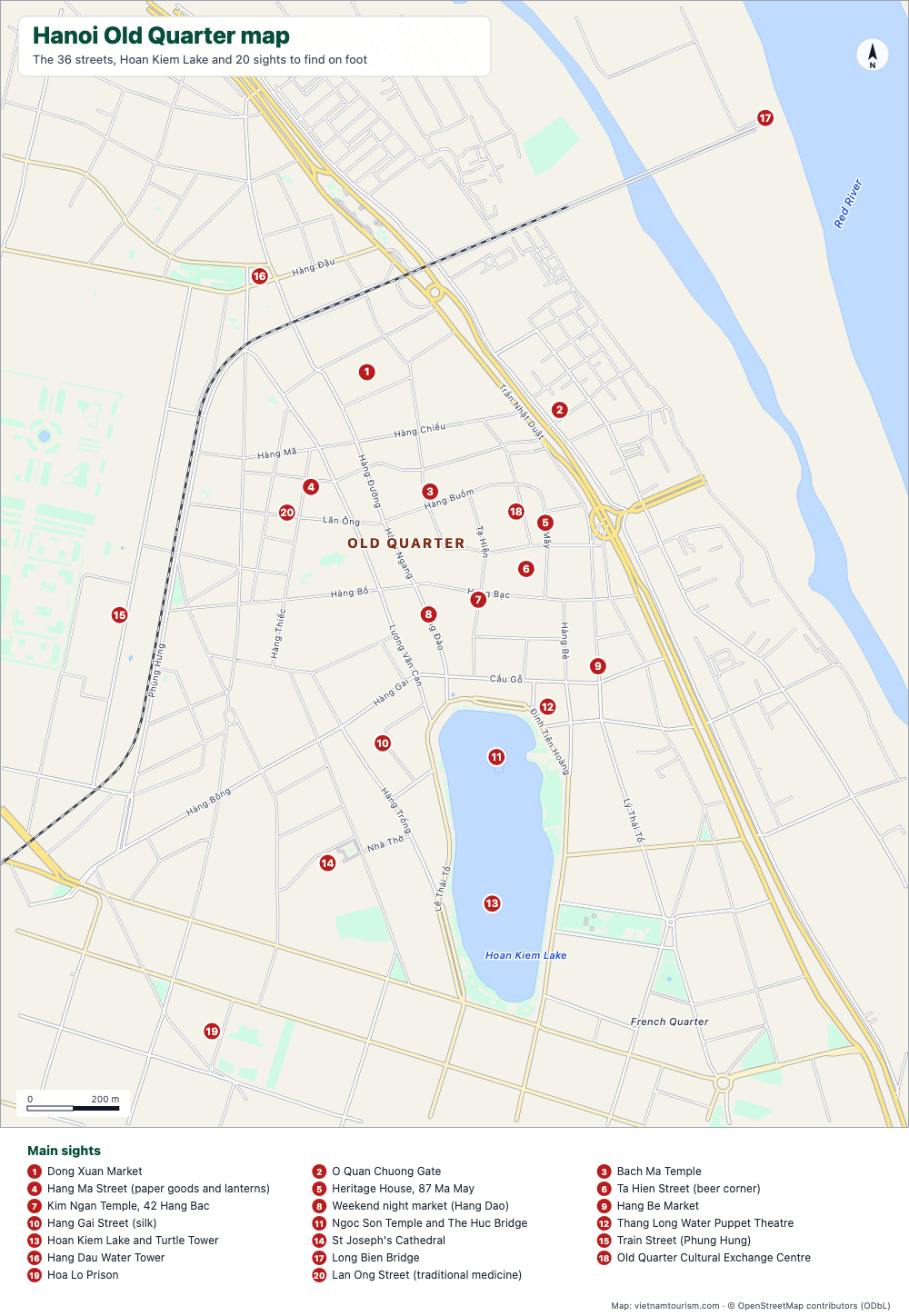
Free printable map of Hanoi's Old Quarter: the 36 guild streets with their names, Dong Xuan Market, Bach Ma Temple, Hoan Kiem Lake and 20 numbered sights. PDF, PNG and SVG.
PDF · PNG · SVG
Ho Chi Minh City map
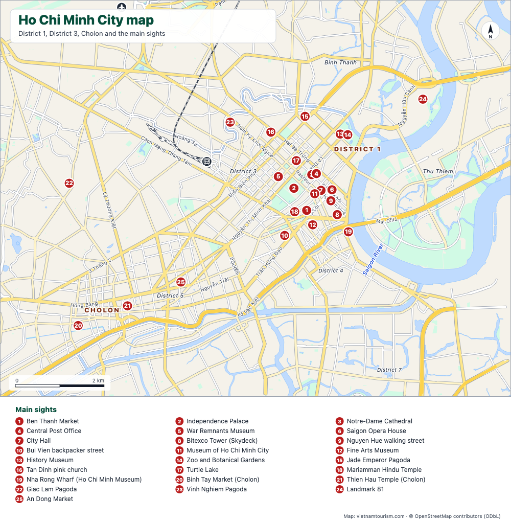
Free printable map of Ho Chi Minh City (Saigon): District 1, District 3, Cholon, Thu Thiem, 25 numbered sights, main avenues, station and airport. PDF, PNG and SVG.
PDF · PNG · SVG
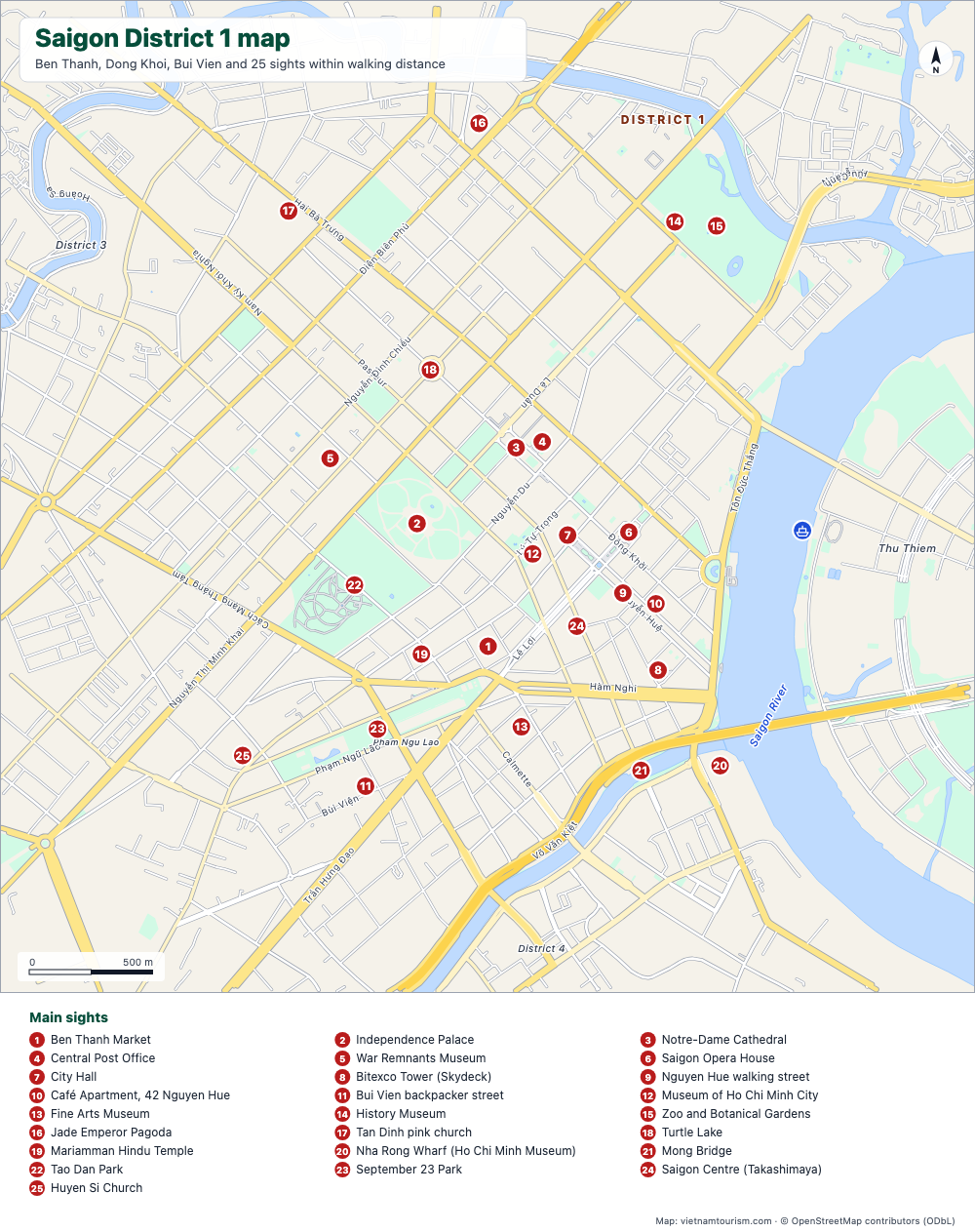
Saigon District 1 map
Free printable map of Saigon's District 1: Ben Thanh, Dong Khoi, Nguyen Hue, Bui Vien and 25 sights within walking distance, with street names. PDF, PNG and SVG.
PDF · PNG · SVG
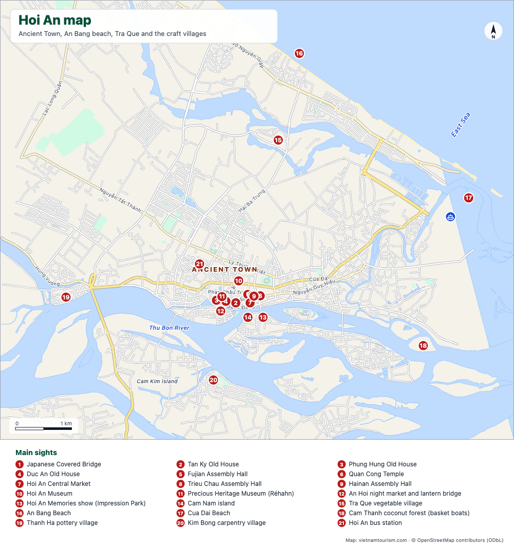
Hoi An map
Free printable map of Hoi An: the Ancient Town, An Bang and Cua Dai beaches, Tra Que, the craft villages, the Cua Dai pier and 21 numbered sights. PDF, PNG and SVG.
PDF · PNG · SVG
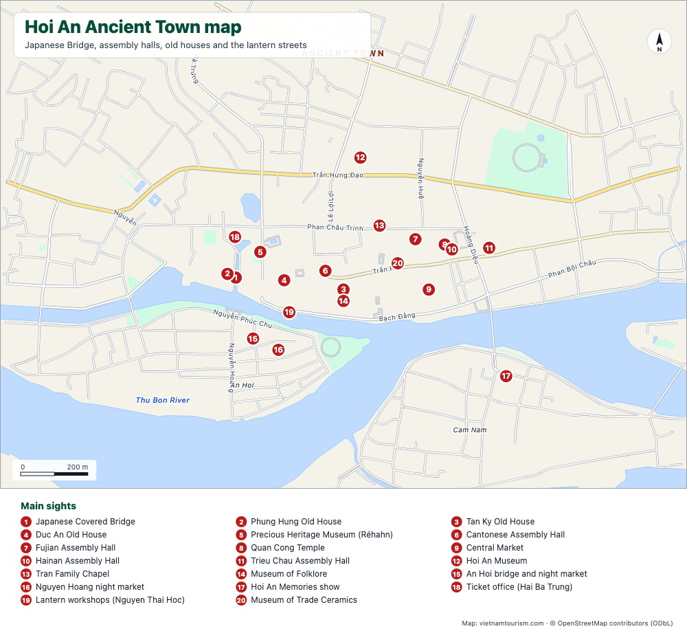
Hoi An Ancient Town map
Free printable map of Hoi An Ancient Town: Japanese Bridge, assembly halls, old houses, museums, market and lantern streets, 20 numbered sights with street names. PDF, PNG and SVG.
PDF · PNG · SVG