Sapa map
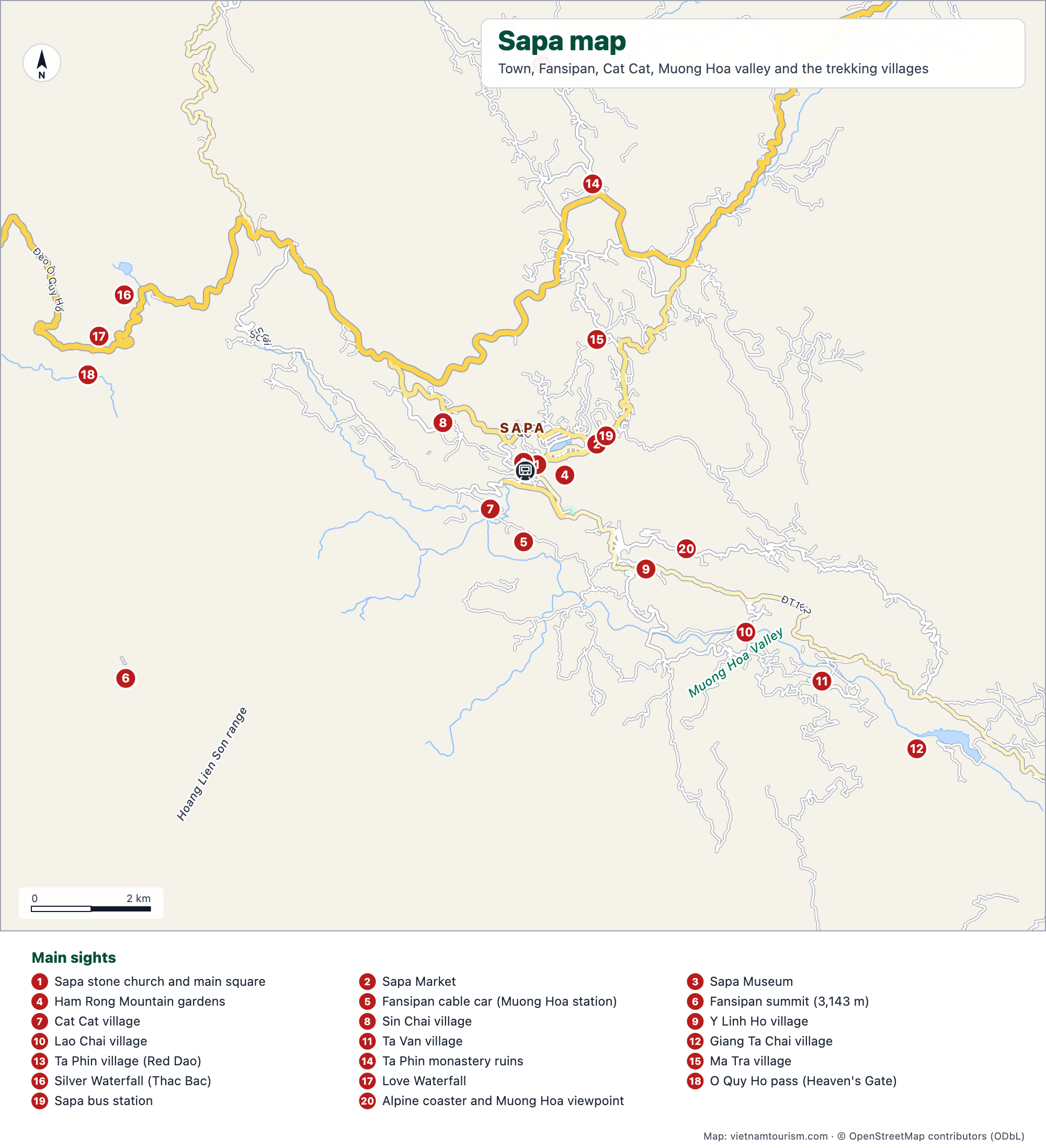
Sapa and the valleys around it: the town with its church, market and funicular, the Hmong and Dao villages along the Muong Hoa valley that the day treks link together, Ta Phin to the north, and the road to the Silver Waterfall and the O Quy Ho pass in the west, with the Fansipan summit in the corner. Twenty-one numbered places and the mountain roads.


Free for personal use · PDF · PNG · SVG
What's on the map
- 1Sapa stone church and main square
- 2Sapa Market
- 3Sapa Museum
- 4Ham Rong Mountain gardens
- 5Fansipan cable car (Muong Hoa station)
- 6Fansipan summit (3,143 m)
- 7Cat Cat village
- 8Sin Chai village
- 9Y Linh Ho village
- 10Lao Chai village
- 11Ta Van village
- 12Giang Ta Chai village
- 13Ta Phin village (Red Dao)
- 14Ta Phin monastery ruins
- 15Ma Tra village
- 16Silver Waterfall (Thac Bac)
- 17Love Waterfall
- 18O Quy Ho pass (Heaven's Gate)
- 19Sapa bus station
- 20Alpine coaster and Muong Hoa viewpoint
Other maps
Hanoi tourist map
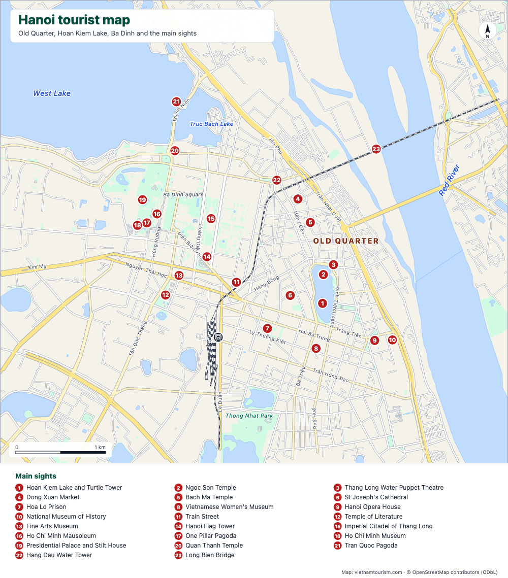
Free tourist map of Hanoi to print: Old Quarter, Hoan Kiem Lake, Ba Dinh, 23 numbered sights, main streets and the train station. PDF, PNG and SVG.
PDF · PNG · SVG
Hanoi Old Quarter map
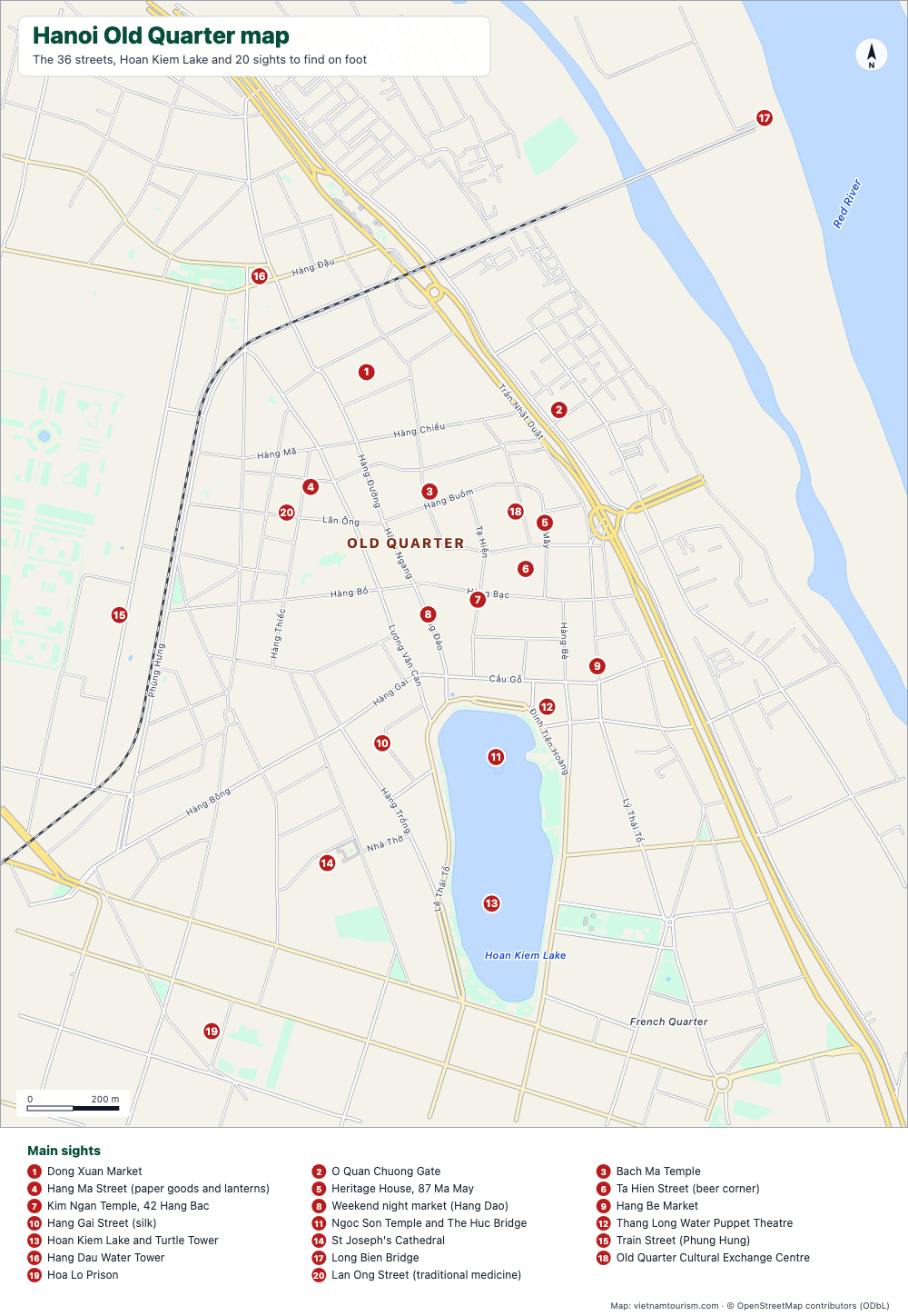
Free printable map of Hanoi's Old Quarter: the 36 guild streets with their names, Dong Xuan Market, Bach Ma Temple, Hoan Kiem Lake and 20 numbered sights. PDF, PNG and SVG.
PDF · PNG · SVG
Ho Chi Minh City map
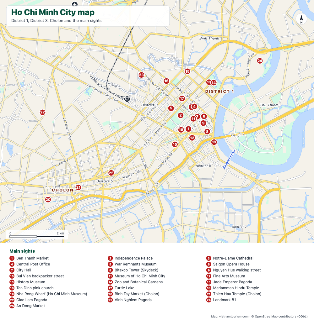
Free printable map of Ho Chi Minh City (Saigon): District 1, District 3, Cholon, Thu Thiem, 25 numbered sights, main avenues, station and airport. PDF, PNG and SVG.
PDF · PNG · SVG
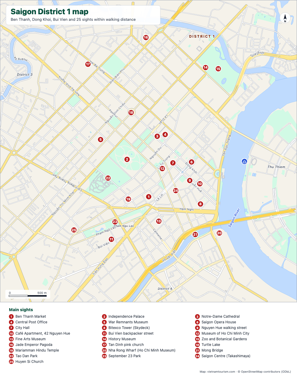
Saigon District 1 map
Free printable map of Saigon's District 1: Ben Thanh, Dong Khoi, Nguyen Hue, Bui Vien and 25 sights within walking distance, with street names. PDF, PNG and SVG.
PDF · PNG · SVG
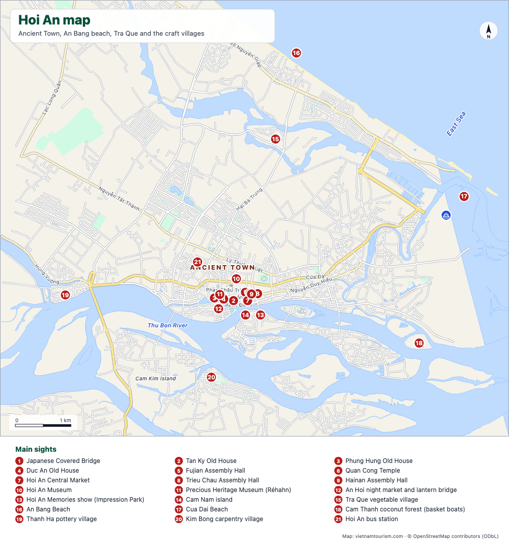
Hoi An map
Free printable map of Hoi An: the Ancient Town, An Bang and Cua Dai beaches, Tra Que, the craft villages, the Cua Dai pier and 21 numbered sights. PDF, PNG and SVG.
PDF · PNG · SVG
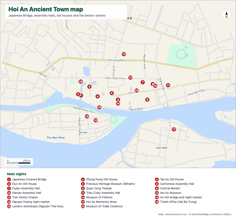
Hoi An Ancient Town map
Free printable map of Hoi An Ancient Town: Japanese Bridge, assembly halls, old houses, museums, market and lantern streets, 20 numbered sights with street names. PDF, PNG and SVG.
PDF · PNG · SVG